YOU HAVE A LOT OF FREEDOM TO CUSTOMISE YOUR MASTER’S IN GEO-INFORMATION SCIENCE AND EARTH OBSERVATION.
Within the Master’s in Geo-Information Science and Earth Observation, you build expertise in a specific field by following one of the seven specialisations. In addition, you can tailor your Master’s to your interests and ambitions by choosing elective courses. The freedom to customise your programme will ensure you become the geo-information specialist you want to be.
Co-decide the content of your master's
The choice of Chamidu Gunaratne
“In my home country, Sri Lanka, there is an erosion problem on the coast and the government has implemented a lot of projects to save the coast. In my research, I used satellite imagery to investigate if these projects were effective. This specialisation is a good fit for me because I love geology and want to learn to use the latest remote sensing technologies.”
The choice of Carolina Ferman Carral
“I love that we not only use geo-information but also learn to apply it to real-life cases. For example, I learned to use databases of landslides and data about the characteristics of a given geographic area to predict where landslide could occur and what the effects would be for the community there.”
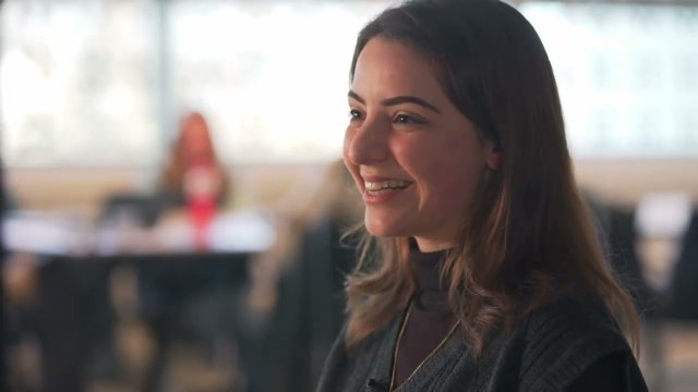
The choice of Ali Surojaya
“I am interested in the application of AI for geo-information science and Earth observation. I have taken courses in Python and R and now I can apply my programming skills by using different geo-information tools. In my master’s research, I am developing a deep-learning model that will help drones detect an opening in a building for urban search and rescue.”
- Specialisation in Geoinformatics
- Elective courses in: Spatio-temporal Analytics and Modelling; Advanced Image Analysis
The choice of Udipta Boro
“Cities are growing rapidly. However, not everyone can benefit from this rapid urbanisation. One example of this could be the development of slum areas. During my master's degree, I used satellite imagery to identify slums and their characteristics. Such analyses could help stakeholders make better decisions on addressing issues facing slums and slum dwellers.”
The choice of Amanda De Liz Arcari
“I chose this specialisation because I wanted to study water quality from space: to use satellite images and remote sensing data to get information about the water quality of lakes or coasts. So, in my research I have developed an index that detects waste water contamination.”
The choice of Ahmed Hemoudi
“I am trying to come up with a geo-information based solution for community leaders and members in Sudan to better document their tenure relations. Especially in cases when internally displaced people come back to their villages and claim access to their land.”
How to compose your Master's
Your curriculum depends on the choices you make when you compose your Master’s. There are two steps you need to take.
At the start of you Master's, you can choose a specialisation: this way, you build expertise in a specific domain in geo-information science and Earth observation. This Master’s has seven specialisations:
More than that, you can also build your own study programme. So, are you keen on combining a few of the specialisations into one? Let’s say you want to explore the use of geospatial data in tourism and dive into geoinformatics, water security, and natural resources? This is possible as you can combine different specialisation courses and set up your own programme.
Step 2: Professional development during your master's Once you have chosen your learning path, it is time to decide what the rest of your curriculum will look like. In addition to the compulsory courses, which depend on the specialisation you choose, you have a great deal of freedom in choosing elective courses. You can choose among more than 15 elective courses, most of which are available to everyone, no matter your specialisation.
In your second year, you can do an internship at a company or a research institute to gain hands-on experience. The internship is optional: if you prefer, you can take elective courses equivalent the internship credits. If you decide that you want to apply what you have learned before your graduation, you can do your internship at consultant companies, government agencies, research institutes, or non-governmental organisations in the Netherlands or abroad. Learn more about the internship and elective options by choosing a specialisation.
STEP 3: Determine the topic of your master's thesis You and your supervisors will determine the precise focus of the topic of your master's thesis research. You can contribute to an ongoing research project or develop your own topic that falls within a research theme at ITC.
Master's structure
During your Master’s in Geo-Information Science and Earth Observation, you will collect a total of 120 EC in the time frame of two years.
Below, you can find the general structure of this Master’s. As you have a lot of freedom to customise your programme, the exact courses you will follow depend on the choices you make at the start of and throughout your studies.
FIRST YEARDuring the first year, parallel to the specialisation courses and the coursework, you also take an academic skills course to gain the necessary skills required to do scientific research in geo-information science and Earth observation. |
Quartile 1 | | During the first quartile, you learn the basics of Geo-Information Science and Earth Observation. The core of the programme (14 EC) consists of three separate courses: |
Quartile 2 | | This quartile is dedicated to two courses from the specialisation you have chosen (14 EC). Each specialisation has its own set of compulsory courses: choose a specialisation and find out which ones. |
Quartile 3 | | You take one compulsory course from your chosen specialisation (7 EC) and a course on how geo-information science and Earth observation address global challenges (7 EC). |
Quartile 4 | | You take one compulsory course from your specialisation (7 EC) and one elective course (7 EC). |
Second yearDuring the second year, you will customise an Individual study programme and work on your MSc research proposal and MSc thesis. |
Quartile 5, 6, 7, and 8 | | During the second year of your Master’s, you predominantly work on your research project. You will also take elective courses of which you have the option to complete an internship. Your research activities could include doing fieldwork, for example abroad, in order to collect data to support your research project. |
Discover the exciting internship options at ITC!
Join us on a journey as we follow two Master students, Carolina Pereira Marghidan and John Ifejube, during their internships at the Faculty of Geo-Information Science and Earth Observation (ITC) at the University of Twente. Get ready to witness the impactful work they're doing in their respective placements and gain a glimpse into the future that awaits you as a prospective student. Watch the video!
Find out more
Are you interested in this Master’s and do you want to know more about your study programme and how to compose it? For example, are you curious about the choice topics, or the learning outcomes? You can find out all about it in our Online Study Guide*.
* You are looking at the Study Guide of the current academic year. We always have the desire to strive for improvement. Therefore the course structure is subject to change.
Study details