Spot

Water Resources and Environmental Management

Learn to apply geo-information and Earth observation techniques to tackle global water-related challenges such as flooding, water scarcity, water pollution, and food safety.

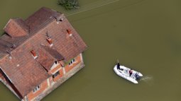
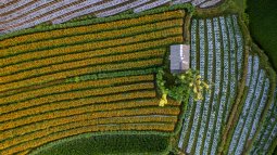
Life would not be possible without one of Earth's most important natural resources: water. However, the world’s population growth is much faster than the increase in the amount of available fresh water. At the same time, fresh water resources like river and lakes are polluted by human activity. Countries are facing frequent floods and droughts often at the same time because of extreme weather and uneven distribution of rains. Meanwhile, a continuous monitoring of water quality for irrigation is crucial for yield and quantity of crops. Would you like to come up with sustainable solutions to tackle these and similar pressing issues? Then the specialisation in Water Resources and Environmental Management is what you are looking for.

Arno van Lieshout, Programme Director Water Resources and Environmental Management Programme.

The focus of the specialisation is on the use of satellite images for water resources. For example, you can use the data to assess if a particular area will be flooded under specific rainfall conditions. Also, you can go further: how fast will it be flooded and what kind of measures could be taken to prevent this?

Arno van Lieshout, Programme Director Water Resources and Environmental Management Programme.

Master's Geo-Information Science and Earth Observation

Registration for this course is now closed. If you wish to be informed of the upcoming registration dates, please provide your contact information.

Dear ,

Thank you for your interest in the course Geo-information Science and Earth Observation. We received your information and will let you know as soon as the new registration period is open.

Should you have any further questions about the course content, tuition fees, available scholarships and more, please visit the course page and feel free to contact us through the email education-itc@utwente.nl if you need any further assistance.

Kind regards,

University of Twente | Faculty ITC

Please note that this message should not be considered as confirmation of registration to any course.

What is Water Resources and Environmental Management?

In the specialisation in Water Resources and Environmental Management, you will work on various assignments utilising geospatial data from multiple sources including satellite imagery. You will learn to analyse if water resources can be used sustainably for agricultural, human, and animal consumption, among other things. Good water management is essential for crops and livestock, so how much water is needed to grow a specific type of crop in a given geographical area? Does the area get sufficient rainfall for this type of crop? What about parameterising an integrated hydrological model with the help of remote sensing, so you can understand water behaviour? This way, you can help stakeholders utilise the available water responsibly by also considering changing (climate) conditions and prevent (future) water scarcity. You will also analyse instances of flood disasters and conduct statistical analyses, so governments can use the information to create evacuation plans and make weather forecasting systems more accurate.

Examples of courses you will follow during this specialisation:
  • In what ways can satellite imagery fill the gaps of ground measurements? In the course Earth Observation of Water Resources, you will learn to obtain rainfall and evapotranspiration estimates, carry out statistical analyses, and visualise them.
  • Satellite observations can be used to asses hydrological components such as lake surface and river heights. In the course Observing and Modelling Surface Water in a Changing World, you will learn to apply radar altimetry to estimate and monitor water heights of larger rivers and lakes.
  • How to map the vulnerability and resilience of coastal areas in relation to water quality and land-based pollution? How to quantify the productivity of aquatic systems? In the course Shades of Blue: Earth Observation of Coastal and Inland Waters, you will apply satellite-based climate variables to describe the interactions between ocean and land.

Thanks to the state-of-the-art geoscience labs, visualisation and usability labs, and satellite and sensor databases available at ITC, you will gain hands-on experience and work on real-life problems and solutions. How can you create a hydrological model for improved flood forecasting in a geographical region susceptible to periodic floods? What about using satellite imagery to look into land cover changes in a city, so you can analyse if it is getting more or less green and help stakeholders come up with sustainable urban planning solutions? There is a great variety of challenges you will learn to solve!

What will you learn?

As a graduate of the Master's in Geo-Information Science and Earth Observation with a specialisation in Water Resources and Environmental Management, you have acquired specific scientific knowledge, skills, and values that will help you in your future career.

Knowledge

After completing this Master’s specialisation, you:

Skills

After successfully finishing this Master’s specialisation, you:

Values

After completing this Master’s specialisation, you:

Other master’s and specialisations

Is this specialisation not exactly what you are looking for? Maybe one of the other specialisations suits you better. You can also find out more about related Master’s at the University of Twente: