Water, food and energy security and environmental safety are key challenges to our societies. Better water resources management requires a fundamental understanding of the water cycle, water climate and water ecosystem interactions and impacts of human activities in the Earth’s climate system. Quantitative earth observation, hydrological modelling and data assimilation provide a powerful combination to quantify hydroclimatic variables for effectively addressing water management issues across the globe.
Research Strategy
We are actively engaged in research and education in applications of earth observation technologies to understand and monitor water availability and food security in terms of water quantity and quality, and water-related disasters, risks and solutions in terms of floods, droughts, (urban) heat, water pollution and health.
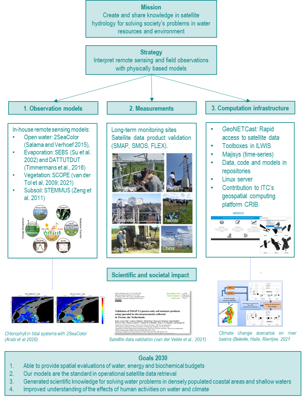
Our mission to “create and share knowledge in satellite hydrology for solving society’s problems in water resources and environment” is achieved by using earth observation, physically-based earth system models and in situ data to address challenges related to water, climate and the environment, and by sharing that information within our scientific field, with stakeholders in the water sector and with the public.

Research Activities
Our research activities include:
Retrieval of surface parameters
Retrieval of surface parameters addresses the question which physical quantities can we actually observe with remote sensing instruments, in particular with sensors operating in a broad range of the electromagnetic spectrum, from the visible, through the near and shortwave infra-red, the thermal domain, up to and including the microwave region. In trying to answer this question, radiative transfer models are applied. Observations from satellites always take place across several media, so the coupling and mixing of models involving different components of the system is very important. With coupled models that include the atmosphere it is possible to study quantitative relationships between object properties on the ground and top-of-atmosphere observations by a satellite. From these quantitative relationships one can derive methods and algorithms to retrieve surface parameters from observed remote sensing data.
Hydrogeology and Ecohydrology
Water scarcity in water limited environments, mainly attributed to declining groundwater resources, is one of the main problems of the 21st century. At the interface between hydrogeology and ecohydrology, the impacts of ecosystems, land cover and climate change on the groundwater balance is compared to those of other components. Here we focus on spatio-temporal assessment of subsurface fluxes with an emphasis on groundwater fluxes and interactions between plants and groundwater. If based on reliable data, coupled, saturated-unsaturated models are very powerful tools, not only in water and natural resources management, but also in studies on the impact of land cover and climate changes on groundwater resources. The recent technological advances in earth observation, i.e. in remote sensing, geophysics and automated field monitoring, create unique opportunities to improve the reliability of such models.
Water Quality and Environmental Security
Water security can be defined as the ability to access sufficient quantities of clean water to maintain adequate standards for food and goods production, sanitation and health. It is of vital importance, because the world is already facing severe water shortages, due to climate and/or human impacts in many parts of the world. Aquatic and coastal ecosystems face similar security threats from climate and weather variations, combined with human influences. In order to evaluate security risks as well as to assess the value of (nature-based) solutions, one must work towards an improved quantitative understanding of the complex relations between the impacts of climate on sea level rise, river discharges, sediment budgets, nutrients and chemical contaminant flows and morphology. Improved understanding of system behaviour can be obtained using Earth Observation together with experimental in situ data and integrated modelling approaches applied to the various processes. An emphasis is put on assessment and monitoring of water quality and biogeochemical variables, being prime indicators of water and environmental system behaviour, and on the physical and ecological functioning of coastal (eco)systems (e.g., coastal sediment dynamics) and nature-based solutions (e.g., wetlands for flood risk reduction).
Water Cycle and Climate Change
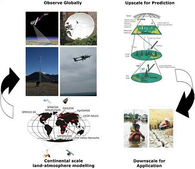
The role of the terrestrial hydrosphere in the Earth’s climate system can be described by climate-related variables, such as radiation, precipitation, evapotranspiration, soil moisture, clouds, water vapour, surface water and runoff, etc. Measurements of these quantities are required to better understand the global climate and its variability, both spatially and temporally, and to help advance our understanding of the coupling between the terrestrial and atmospheric branches of the water cycle, and how this coupling may influence climate variability and predictability. In order to enhance the prediction of global water cycle variations, understanding of hydrological processes and its close linkage with the energy cycle is fundamental. Observations from space and in situ of water cycle components and their interactions with ecosystems, climate and human activities provide opportunities to address a number of key questions:
- How can we quantify the water cycle processes (storages and fluxes, as well as land-atmosphere, surface-groundwater, water-ecosystem and land-oceans interactions?)
- What tools can be further developed/improved to predict the water cycle components (to measure, simulate and predict water cycle quantity and quality in space and time)?
- How can we assess the impacts of and the vulnerabilities to future climate change in water resources and what is the potential to adaptation in water resources management?


