| Student: | K.A. Maslov |
|---|---|
| Timeline: | Started January 2022 |
Glaciers are highly sensitive to alterations in temperature and precipitation, making them important indicators of climate change. In the last decades, the vast majority of glaciers worldwide have diminished in size and are expected to continue retreating, while about half of glaciers are likely to disappear by 2100 regardless of the greenhouse gas emission scenario. This loss in glacier mass contributes significantly to rising sea levels accounting for approximately 25–30% of the observed increase since 1961. The projected rise in sea level from glaciers poses a severe threat to millions of households predicted to be below high tide lines by the end of the century as well as to the availability of fresh water and food in the coming decades. In addition, glacier retreat adversely affects water resource sustainability in densely populated regions, hydroelectric power generation, drinking water quality, agricultural productivity, ecosystems and biodiversity and increases the likelihood of glacial lake outburst floods with possibly devastating consequences.
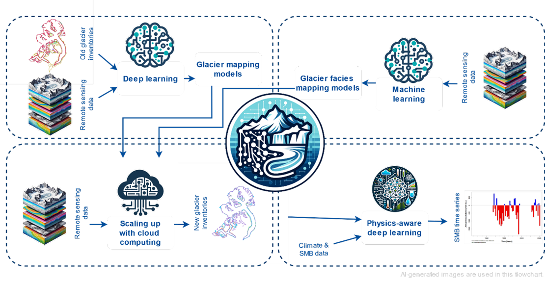
To quantify and deal with the aforementioned challenges, there is a need for consistent global multitemporal glacier inventories and glacier mass balance datasets. Unfortunately, these data are missing, and there are no fully automated methods validated globally to produce them. Thus the overarching goal of this project is to produce a large-scale inventory including detailed glacier maps and surface mass balance time series and make it available to the wider scientific community. To achieve it, we will 1. develop a method based on convolutional neural networks for mapping glacier outlines and 2. a machine learning method for classifying glacier facies, 3. scale up these methods to map glaciers globally and 4. develop a physics-aware model for glacier-wide surface mass balance estimation.
Meet the team