Learn how to acquire reliable UAV data and efficiently process them to extract useful information for precision agriculture, FOR RURAL SURFACE water CONTROL OR FOR AI-based scene understanding
The use of Unmanned Aerial Vehicles (UAVs) or drones has surged in the last two decades, leading to remarkable changes in several remote sensing applications. However, the development of best practices for high-quality UAV mapping is often overlooked, representing a drawback for their adoption in different domains. UAV solutions then require an interdisciplinary approach, integrating different expertise and combining several hardware and software components on the same platform.
This course aims to deliver theoretical and hands-on knowledge to acquire, process and interpret UAV data. The course addresses three specific and alternative application domains: precision agriculture, mapping applied to water control in rural flood-affected areas and application in AI-based scene understanding.
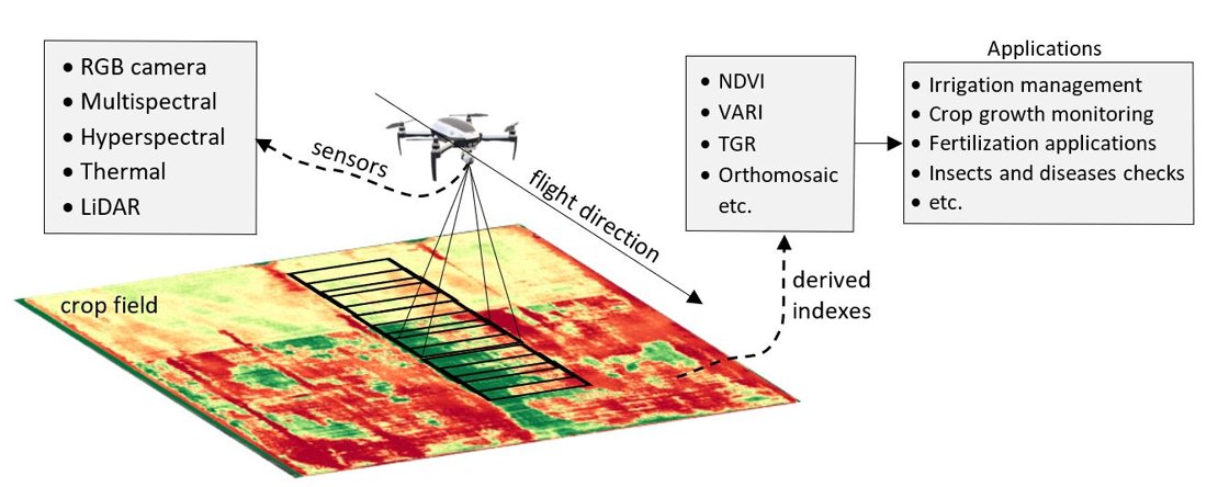
Figure 1: A visualization of the use of UAVs in smart agriculture.
For whom
Are you working with UAVs or interested in this technology and want to learn more about using UAV technology for precision agriculture or the production of maps suitable for flood control modelling? This course will give you the needed knowledge to do that!
Our course on "Precision Agriculture with UAVs" is designed for Bachelor, Master, and PhD students who are eager to specialize in the acquisition and processing of UAV data in the topic of agriculture. Whether you aspire to delve into the academic requirements of agricultural applications or aim to write your MSc thesis on UAVs in agriculture, this course will equip you with the essential knowledge and skills.
Our course on "Mapping Applied to the Water Control with UAVs " is designed for Bachelor, Master, and PhD students. Whether you have prior experience or not, our academic expert instructors will guide you through the essential concepts and techniques. The course emphasizes a hands-on approach, ensuring that you gain theoretical and practical skills that can be applied directly to rural flood management.
Our course on "UAVs for AI-based scene understanding" is designed for Bachelor, Master, and PhD students. Whether you have prior experience or not, our academic expert instructors will guide you through the essential concepts and techniques. Via this course, you will dive into the world of scene understanding and become the ultimate investigator of your surroundings! Our dynamic course blends the art of UAV-based observation with the science of AI-based scene understanding algorithms.
Course content
The course addresses three specific and alternative application domains: precision agriculture, water control and scene understanding.
Note:
Upon registration, you choose one application domain!
UAVs for prescision agriculture The course is divided into two modules.
Module 1: Mapping with UAVs
You will learn how to generate 2D and 3D maps from overlapping UAV images in support of precision agriculture, according to well-established steps, such as:
- structure from Motion (SfM)
- point cloud and orthophoto generation
- DSM and DTM extraction.
Flight planning and onboard sensors to use in precision agriculture will be analysed in detail too.
Module 2: UAVs for precision agriculture
In this second module, you will learn how to use, process, and interpret the 2D and 3D maps created in Module 1.
- Why use UAVs in agriculture? Introduction to using spatial data from UAVs in agriculture.
- What is growing in this field? Introduction and hands-on exercises to inventory plants and crops.
- Are these plants healthy? Introduction and hands-on exercises to vegetation and crop indices from RGB, multispectral, and thermal maps.
- Are these plants water-stressed? Introduction and hands-on exercises to plant water use and plant stress calculations.
- Bonus lecture (e.g., on wildlife and livestock monitoring).
UAVs use on mapping for water control in rural flood-affected areas The course is divided into two modules.
Module 1: Mapping with UAVs
In the first essential module, you will learn how to generate 2D and 3D maps from a set of overlapping UAV images in support of water management. You do this according to well-established steps such as:
- structure from Motion (SfM)
- point cloud and orthophoto generation
- DSM and DTM extraction.
Flight planning and onboard sensors to use in water management will be analysed in detail too. The module will be illustrated with videos explaining step by step the work needed to be done for this application both in terms of field and air survey. Note that flood modelling is not part of the course as it requires knowledge of surface hydrology and hydraulics.
Module 2: UAVs for water control
In the second module, you will learn decision rules for the generation of products such as specialized DTM for flood analysis, vegetative and hydraulic property maps, and the planning, execution and extraction of bathymetries for permanently flooded bodies and the organization of this information in files compatible with flood modeling software. The content aims to give answers to the following questions:
- How to combine a UAV generated DSM, DTM and field survey to produce a proper digital elevation model for flood structural control?
- How to use these maps to build hydrological circuits where a flood can be controlled independently.
- How to reclassify the UAV georeferenced orthomosaic into a roughness map for hydraulic modeling?
- How to support vegetation mapping for seasonal hydraulic modeling?
- How to evaluate the natural volumetric capacity to store surface water of the affected area?
- Do you have lakes or ponds in your area? How to use bathymetric tools and GIS to quantify water volumes in areas inaccessible to UAVs.
- How to do highly accurate and GIS ready field survey data collection with simple mobiles.
- Finally, how to compile all this information in a GIS project standardized for direct use in flood modeling and the modeling of control structures.
UAVs for AI-based scene understanding The course is divided into two modules.
MODULE 1: MAPPING WITH UAVS
You will learn how to generate 2D and 3D maps from overlapping UAV images in support of precision agriculture, according to well-established steps, such as:
- structure from Motion (SfM) point cloud and orthophoto generation DSM and DTM extraction.
Flight planning and onboard sensors to use in precision agriculture will be analysed in detail too.
MODULE 2: AI-based scene understanding
In this second module, you will learn how to use, AI and learning-based strategies for semantic segmentation and object extraction. The content aims at:
- Introduction to scene understanding Semantic segmentation Object detection Neural networks and their use for scene classification.
What will be achieved?
Read about the gained skills and knowledge after completion of the course.
UAVs for precision agriculture In this course, you will gain the skills and knowledge to effectively utilize UAVs in precision agriculture. By the end of the course, you will be able to generate 2D and 3D maps, analyze vegetation and crop health, assess water stress, and even explore topics like wildlife and livestock monitoring. This hands-on training will equip you with the expertise needed to harness spatial data from UAVs for enhanced agricultural practices.
UAVs use on mapping for water control in rural flood-affected areas By completing this course, you will acquire the necessary expertise to employ UAVs for mapping in water management and flood control. You will learn how to generate accurate 2D and 3D maps, develop specialized flood analysis products, assess hydraulic properties, and utilize bathymetric tools for water volume calculations. With practical training and comprehensive knowledge, you will be able to compile and apply this information directly in GIS projects for flood modeling and control.
UAVs for AI-based scene understanding In the scene understanding module, students will learn the basics of AI and deep learning with specific regard to semantic segmentation and object detection algorithms. The aim will be to use these algorithms to classify the scene acquired by UAV data and detect objects of interest in urban and rural contexts.
Online learning, what is it like
Study material will be available for offline study (eg prerecorded lectures, assignments with video instructions), and for the best learning experience, we include dedicated moments in which we meet, discuss and learn online. In addition, since the course runs parallel to the in-class course at ITC, you can attend in-class lectures (if organised) via a live stream and interact with online and in-class students to share practical and fieldwork experiences in dedicated feedback sessions.
The course has been designed for ten weeks and is composed of
- prerecorded practical and assignments (with video instructions)
- reading material and self-study
- online feedback sessions and discussions.
The online activities will be recorded and available for offline study (recap). For some practicals and assignments it is possible to perform adaptive fieldwork yourself, following the instructions provided in the course, and receive feedback from the tutors. Problems with downloading large files? No worries; we will deliver the transcript of the recordings.
Study load
The study load of the entire 10-week course is 5EC. You need to spend a minimum of 12-14 hours per week on the course. The course ends with an assignment with a study load of 12 hours.
About your diploma
Upon successful completion of this course, a Certificate will be awarded to those who have attended the course and fulfilled the exercise requirements. The Certificate will include the name of the course and serve as a testament to your dedication and accomplishments.
Additionally, you will receive a Course Record detailing the subjects studied, course code, exam date, and the grade awarded. These documents will confirm your achievements and serve as valuable credentials for your professional development.
Admission requirements
The course is intended for BSc and MSc students and PhD candidates who want to learn about using UAVs for precision agriculture or water management applications.
There are no specific admission requirements. Basic knowledge of imagery and using UAVs are positive elements of attending this course.
Technical requirements for online education and assessment
You will receive the needed software licenses.
For online education, we formulated guidelines to guarantee optimal performance. The webcam and headset requirements must be met for online oral exams and proctoring during online assessments.
Key information