Over the last decades, Indonesia has undergone a major transformation from previously large forest areas towards a crop-dominated landscape of rubber and oil palm plantations.
Due to population growth and the increased demand for palm oil from the industry, many farmers decide to cultivate oil palm on their terrains and many large scale oil palm plantations are established. Almost every processed food product that we can find in a supermarket contains some amount of palm oil, turning this crop into an attractive source of income for smallholder farmers on a small scale to even large corporations that own large land surfaces.
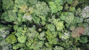
Drone overview of the Indonesian forests (Credits: Florian Ellsäßer)
However, transforming forests or diverse agroforest landscapes into these monoculture plantations may have dramatic consequences for the environment. Farmers notice a decline of soil moisture, and shortages of water are taking place when oil palm is cultivated increasingly . Climate change might have a role in this problem too, but oil palms are “super-productive”, or in other words, potentially consuming higher amounts of water than less productive forests. The increase of cultivation of these species might be increasing the plant water demand and lead to dryer soils. Additionally, the process of forests being transformed into rubber or oil palm plantation normally brings biodiversity loss. Insects, birds and other species lose their natural ecosystems when a forest is converted to a monoculture plantation such as oil palm .
An international “effort” for knowledge
To gain in-depth knowledge about the working of forests and different forms of oil palm cultivation, and how to maintain or restore ecosystem functions on these plantations, the EFForTS project was started. This project is funded by the Deutsche Forschungsgemeinschaft (DFG, German Research Foundation). In collaboration with researchers from the University of Göttingen (Germany) and the Indonesian universities IPB University (Bogor), UNTAD (Tadulako University, Palu) and UNJA (University of Jambi) and others , as well as Associated Scientists from the NRS Department from the ITC Faculty, there is a total of more than 160 researchers, working in close cooperation while representing a wide range of fields.
|
|
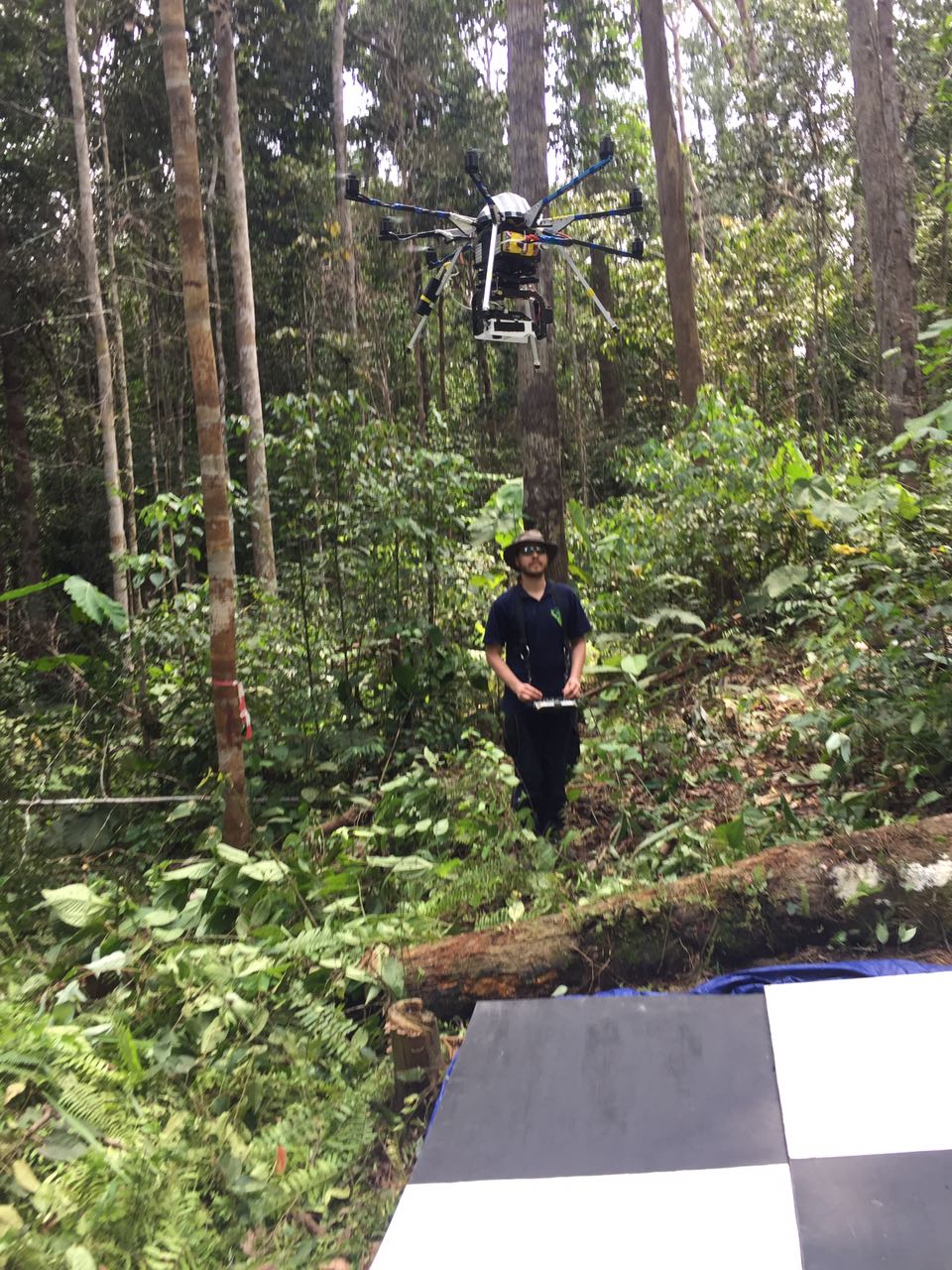
Dronework in PT REKI forest and PT Humusindo plantation, Indonesia (Credits: Florian Ellsäßer)
Due to its size, the EFForTS project is divided into three major groups: “Environmental processes”, “Biota and ecosystem services”, and “Human dimensions”. These groups have around fifteen subgroups with a few researchers for each subgroup. In this large project, plots with different sizes of forests, monoculture palm oil plantations and other cropping systems are used to be studied. A large set of variables is measured within these plots; from details on trees, soil, biomass, insect species, atmospheric exchange, human impact…
As part of group A, “Environmental processes”, Florian Ellsäßer, now Assistant Professor at the NRS Department of the ITC Faculty conducted his PhD. “From the remote sensing side, we were able to collect a very unique data set including UAV images and maps from from forests, smallholder farms and large scale plantations covering all the major land use types of the region in the thermal and visible spectrum. These remote sensing data can be used to derive information on forest inventories, plant biomass, yield predictions and water traits such as evapotranspiration and water stress indicators or be upscaled to much larger areas” explains Florian.
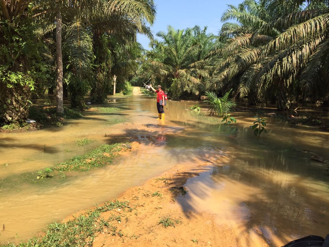
Drone overview of oil palm plantations (Credits: Florian Ellsäßer)
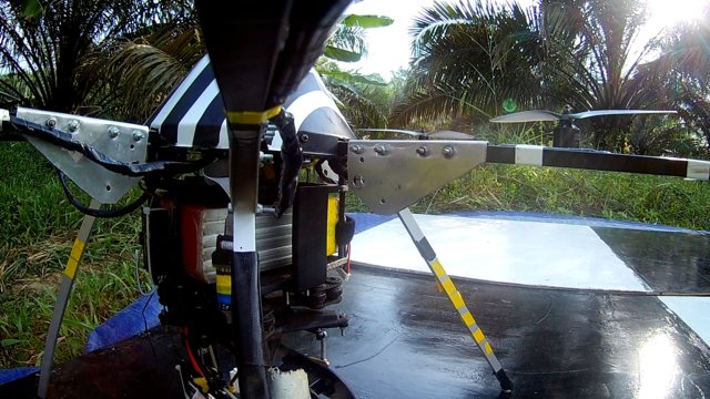
Florian’s PhD topic was to test methods and derive the water use of forests and palm oil plantations from UAV/drone recorded data. For this, he conducted measurements with UAVs using different sensors such as thermal, multispectral, and RGB cameras to assess plant water use. He travelled to Indonesia several times, where he had the chance to conduct several UAV campaigns in forest and oil palm environments. “I really enjoyed the research and had a great experience in Indonesia. During rainy and dry seasons, we went to the field and deployed the drones over all types of forest and plantation types. The rainy season was especially challenging since many of the plots were completely flooded and we had to protect the drones and our other gear from surprisingly strong rains” explains Florian. Although his work on the project is finished, he currently maintains some scientific collaborations processing the obtained data.
Three phases to reach new heights
Florian Ellsäßer’s participation at EFForTS took place during the second phase of the project. There are three phases to EFForTS. The first phase of the project focused mainly on the differences in ecological and socioeconomic functions of land-use changes due to transforming forests into rubber and oil palm plantations. Phase two focused on heterogeneity, as a new umbrella theme. The third phase extends the previous theme (heterogeneity) in space and time, aiming to upscale the data of the current local plots to larger areas using remote sensing.
Michael Schlund, assistant professor of the NRS Department of the ITC Faculty supports the researchers from the University of Göttingen in Germany and the Indonesian universities IPB University (Bogor), UNTAD (Tadulako University, Palu) and UNJA (University of Jambi) and others in the development of this last phase. “The plots are representative of a very specific area, such as lowland forests or oil palm plantation. The idea is to link the knowledge of the plots to various remote sensing data and then learn how that can serve for upscaling through different modelling techniques”.
| |
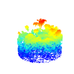
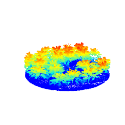
Animations showing the LiDAR point cloud of a forest (left) and an oil palm plantation (right). The colours represent the height above ground (Credits: Michael Schlund)
The end of phase three will carry the end of the project. At that moment, all the research developed by the EFForTS team will be published and shared with stakeholders in the hopes of achieving a sustainable future for oil palm plantations while the industry continues to grow in Indonesia.
More information about the project
EFForTS is a Collaborative Research Centre 990 funded by the Deutsche Forschungsgemeinschaft (DFG, German Research Foundation). In the EFForTS project, more than 160 researchers from the University of Göttingen in Germany and the Indonesian universities IPB University (Bogor), UNTAD (Tadulako University, Palu) and UNJA (University of Jambi) work in close cooperation, representing a wide range of disciplines including ecology, forestry, agriculture, remote sensing, economics, human geography, and cultural anthropology. Click here to learn more about the EFForTS project.
Michael Schlund’s research on this project includes papers such as "Vegetation canopy height estimation in dynamic tropical landscapes with TanDEM-X supported by GEDI data" and "Spaceborne height models reveal above ground biomass changes in tropical landscapes".
Florian Ellsäßer's research on this project includes papers such as “Predicting evapotranspiration from drone-based thermography–a method comparison in a tropical oil palm plantation”, "Predicting tree sap flux and stomatal conductance from drone-recorded surface temperatures in a mixed agroforestry system—A machine learning approach", "Introducing QWaterModel, a QGIS plugin for predicting evapotranspiration from land surface temperatures" and "Drone‐based photogrammetry‐derived crown metrics for predicting tree and oil palm water use".
Contact Michael Schlund for more information about this project

More recent news
 Fri 10 Oct 2025ECO-MOSAIC: A new ESA-funded project to monitor biodiversity under Climate Change
 Wed 1 Oct 2025Erasmus+ funds the GEM Programme for 4 more intakes on its 21st anniversary
 Tue 22 Jul 2025In Memoriam: Dr. Abel Chemura
 Mon 30 Jun 2025GEM Joint Event 2025
 Fri 6 Jun 2025PhD candidate Novia Arinda Pradisty receives KNAW grant to research mangrove ecosystems