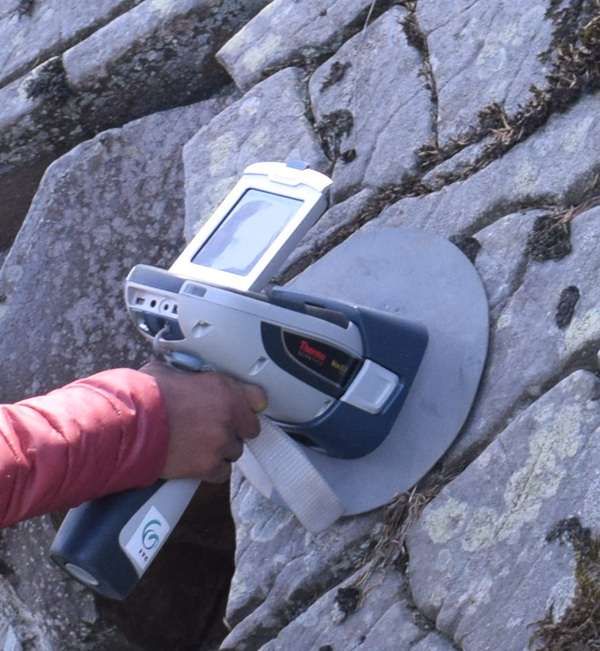
We develop expert systems for mapping earth materials with high spectral resolution remote sensing. These processing chains provide mineralogical, chemical and physical material parameters and are validated by traditional laboratory methods. Applications are regional geological mapping as well as proximal sensing of rock faces, drill cores and rock samples.
Contact person: dr. Harald van der Werff
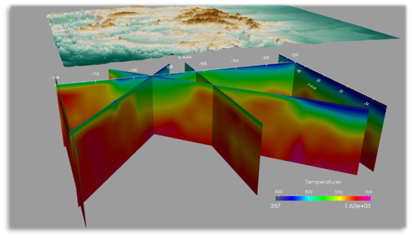
We use a range of approaches, from remote sensing to advance computational modelling to develop and advance exploration techniques in the context of energy transition. Through long-term monitoring of geothermal fields we also try to understand the natural effects of environmental changes and the anthropogenic effects of exploitation on the ‘motor of geothermal systems’.
Contact people: Assoc. Prof. dr. Juan Carlos Afonso and Assoc. Prof. dr. Chris Hecker
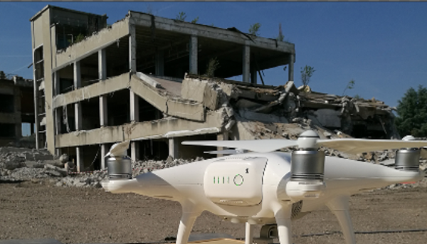
We develop remote sensing-based methods for the detection of structural and functional damage, and for post-disaster recovery assessment. Our work involves 3D scene reconstruction from multi-perspective UAV data and the use of machine learning, but also the integration with satellite image data and other sources, and a coupling to macro-economic modelling for recovery scenario development.
Contact person: Prof. dr. Norman Kerle
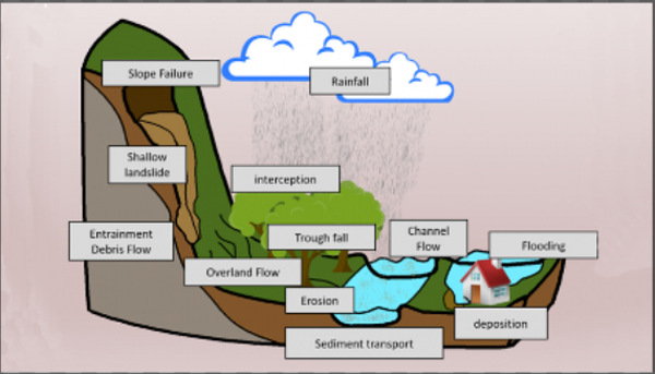
Contactperson: Prof. dr. Victor Jetten
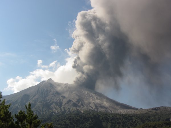
We take a multidisciplinary approach, integrating natural and social sciences approaches, to improve our understanding of volcanic hazards and their impacts in order to reduce local and global volcanic risk.
Contact person: Assoc. Prof. dr. Heather Handley
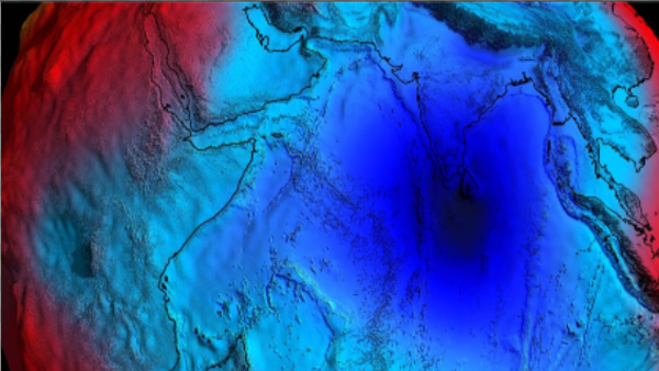
We aim to obtain a better understanding of the geodynamics of the earth and its action on the earth surface. We integrate satellite-based and traditional geophysics for 3D/4D modelling of the composition and state of the crust and lithosphere, and of related dynamic processes. Physics-based ground-motion analysis and simulation are used to link subsurface processes to landslides and other surface manifestations.
Contactperson: Prof. dr. Mark van der Meijde
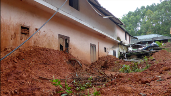
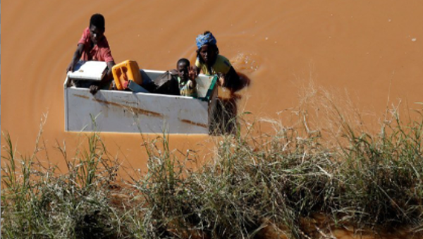
We study how dynamic risk of interacting natural hazards can be quantified for improved decision making in disaster risk reduction. We develop methods to quantify the impact of disaster events on the natural and built-up environment. Our tools and techniques can be applied in different phases of a disaster risk management cycle, and in a context of changing multi-hazards. These changes can take place at different time scales (long term and short term), and can be both gradual and abrupt.
Contactperson: Prof. dr. Cees van Westen
Contact person: Prof. dr. Maarten van Aalst and Prof. dr. Marc van den Homberg
Contact