| Student: | B.E. Hernandez Sandoval de Cherrington |
|---|---|
| Timeline: | January 2025 - 1 January 2029 |
Worldwide, there has been an increase in both population and urbanization. While an estimated 55% of the world’s population currently inhabits urban areas, that proportion is projected to increase to 68% by 2050. As urbanization increases, more people have been impacted by the urban heat island (UHI) effect, whereby urban areas trap heat, becoming much warmer than their surroundings, with adverse health and economical consequences for inhabitants. Frameworks for monitoring urban heat risk facilitate identifying the populations most vulnerable to the extreme heat resulting from the urban heat island (UHI) effect.
Such frameworks have been designed specifically for their focus cities and have also been extensively developed in high income countries (HICs) in the Northern Hemisphere, in contrast with the low and middle income countries (LMICs) in the tropics. Recent research highlights that the tropics are already exposed to extreme heat, and with an increasing tendency to have more frequent long heatwaves compared to other regions. The tropics also face challenges in adapting to hazards, partly because 85% of the world’s lowest income inhabitants live in this region. Nevertheless, data from various Earth Observation (EO) satellites allow for sub-daily monitoring of land surface temperature (LST), and that is especially relevant for regions like the tropics where national weather data are not easily accessible. Such LST data are key components of urban heat risk frameworks and are therefore crucial for understanding and mitigating the UHI effect.
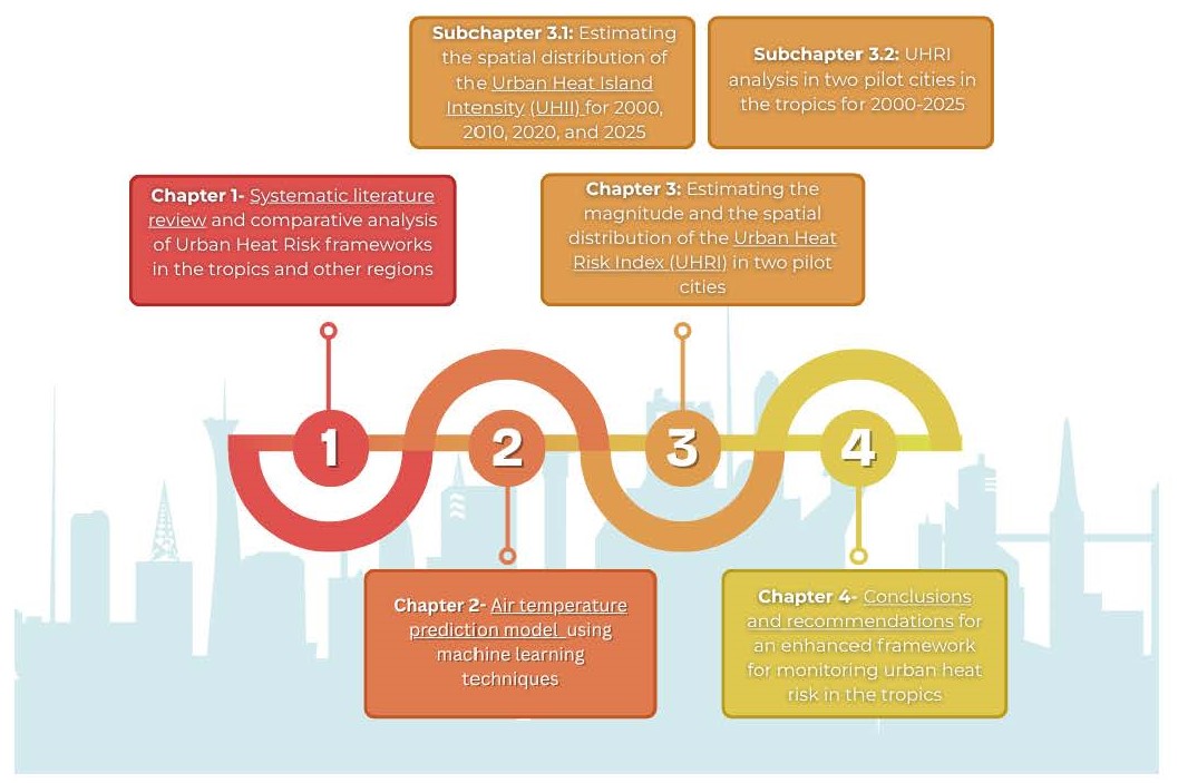
To enhance existing urban heat risk frameworks, we propose exploring the development of a machine learning model for predicting air temperature, expanding beyond work which has traditionally built on land surface temperature data. Over this PhD’s four year duration, we propose to combine Earth observation and socioeconomic data to assess trends and changes in urban heat risk in two pilot cities in the tropics (San Salvador, El Salvador and Kampala, Uganda). This research will include developing a systematic literature review, assessing urban heat risk in the tropics, and comparing the results with frameworks developed in other regions. This work will conclude with a summary of the findings and recommendations for how to enhance frameworks for monitoring urban heat risk in the tropics. This effort will also involve thorough consideration of the ethical implications of this research on potential vulnerable populations in the proposed pilot cities.
Meet the team