WP1 will deploy field measurements of groundwater level, soil moisture and soil temperature, evaporation and meteorological variables and simulations with an advanced physical process model, the assumption of well-watered grass as the reference vegetation will be examined for (past) drought events to determine the actual evaporation, and its difference to estimates in current practice.
WP1 will also study the effects of local advection which has been observed in irrigated vineyards and in the forest Speulderbos. Specific use of DTS (Distributed Temperature Sensing) will enable the determination of local advection effects together with numerical simulations. This knowledge of local advection can be used to better estimate actual evaporation and guide sprinkler-irrigation during droughts. The field measurements will be carried out in the locations at Zeewolde and Herenboeren Wenumseveld (see Figure 2 for locations, and Figure 3 for experiment design).
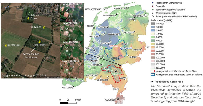
Figure 2 Field locations, catchments, hydrometeorological observations; and satellite images of the voedselbos Ketelbroek (established in 2009) which was resilient to the 2018 drought (fields in brown were damaged ryegrass).
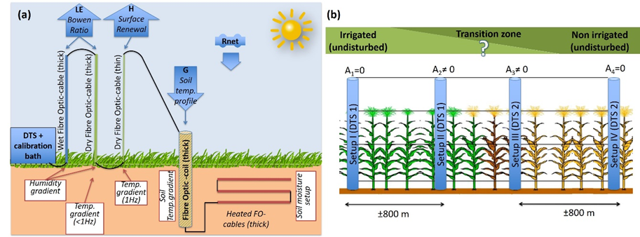
Figure 3 (a) Basic DTS setup to measure spatially the thermodynamic states of the soil, the surface and the atmospheric surface layer. Energy balance fluxes are derived from local gradients (see WP1 in section 3 for details); (b) Setup to measure the advection (e.g., example of advection caused by irrigations).