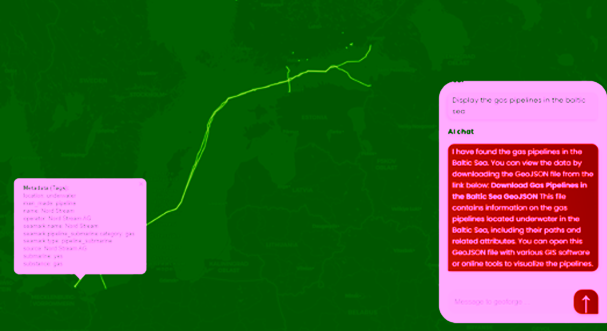
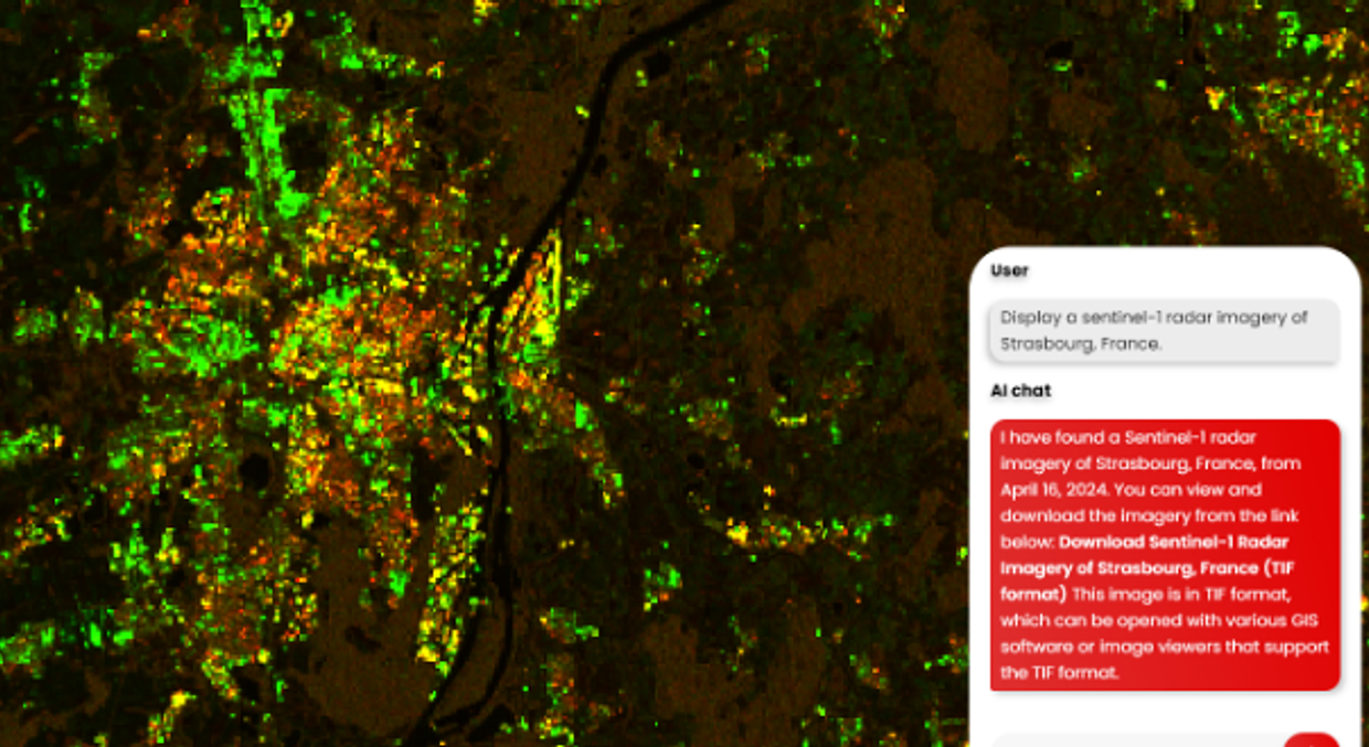
Analysing geospatial data is unfortunately quite a complex task for non-specialists, especially during emergencies such as a flood. To support accessibility for everyone, Ageospatial uses natural language and human interaction to make geospatial analyses.
Their story started in January 2024, when a group of friends in Switzerland developed a plugin named ‘Geo+ for ChatGPT’ (formerly GeoGPT) on the ChatGPT Store. The plugin was successful, attracting 1000 users in less than a month and generating traction. It was able to do basic geospatial data operations such as generating, processing and exporting geospatial data (geocoding, clipping, country boundaries, population, buildings, satellite imagery…).
In response to the success of the plugin, Ageospatial developed ‘GeoForge’, a web platform to make location data (geospatial) analysis accessible for vulnerable communities, to support them in their response to their natural disaster and extreme weather event-related emergencies.
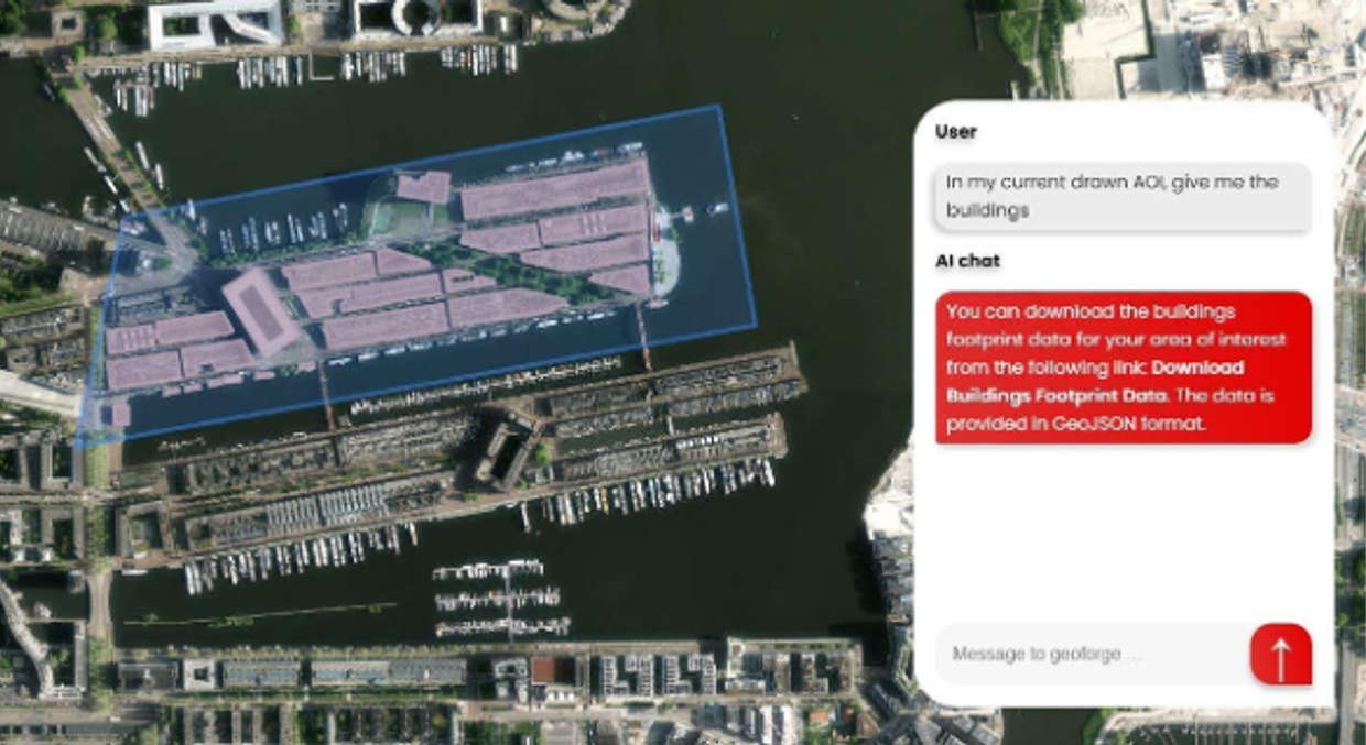
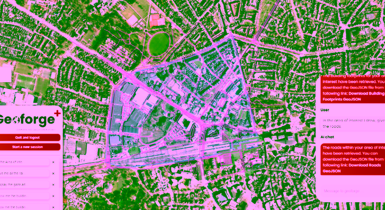
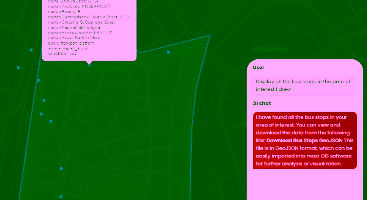
This platform supports data-friendly users within authorities, responders and NGOs, insurance, and engineering firms to rapidly assess damage from natural disasters, analyze previous risks and predict the upcoming ones by mapping critical infrastructure (roads, hospitals, powerlines, affected population…), by removing technical barriers and improving accessibility, unlike traditional geospatial software.
Ageospatial was co-founded by GEM alumnus Maaz Sheikh, who leads the start-up as the current CEO, supported by the co-founder Kevin Torrin who heads the operations.

Current Ageospatial team winning the 3rd prize of the Swiss International Cooperation Award 2024, Néo Coquidé (left), Kevin Torrin (right) and Maaz Seikh (middle).
Application for floods in Bangladesh
GeoForge was used for analysing a flood event in Bangladesh. In less than 30 seconds and by using a text prompt, the platform was able to display near real-time satellite imagery, and extract the flood extent. This was cross-referenced with geodata about critical infrastructure like power lines, water pipes, hospitals, roads, and rail systems as well as building and population datasets. This analysis helps determine the impact of the flood, such as estimating the number of people without power, assessing the accessibility of hospitals given the road conditions, evaluating property damage, and identifying whether the affected area was known to be at risk. This information is crucial for effective response and planning, including preventive measures for future incidents.
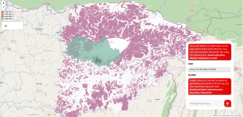
Displaying a provincial boundary in northeast Bangladesh with the population layer (white) and the flood extent (purple) intersected to get the affected people's information. Moreover, the boundaries of the city of Sylhet are displayed.
The future of GeoForge
The Ageospatial team recently won the 3rd prize at the Swiss International Cooperation award, in 2024 helping them to implement a pilot project using GeoForge in Bangladesh, North Macedonia or Kenya by creating extensions that apply to local contexts.
The team is currently working on integrating their application with DuckDB’s Spatial Extension for handling large datasets and enhancing their capabilities.
More information about Ageospatial can be found on their website or their LinkedIn page, where they regularly engage with their +2k followers.
More recent news
 Fri 10 Oct 2025ECO-MOSAIC: A new ESA-funded project to monitor biodiversity under Climate Change
 Wed 1 Oct 2025Erasmus+ funds the GEM Programme for 4 more intakes on its 21st anniversary
 Tue 22 Jul 2025In Memoriam: Dr. Abel Chemura
 Mon 30 Jun 2025GEM Joint Event 2025
 Fri 6 Jun 2025PhD candidate Novia Arinda Pradisty receives KNAW grant to research mangrove ecosystems