Region: International
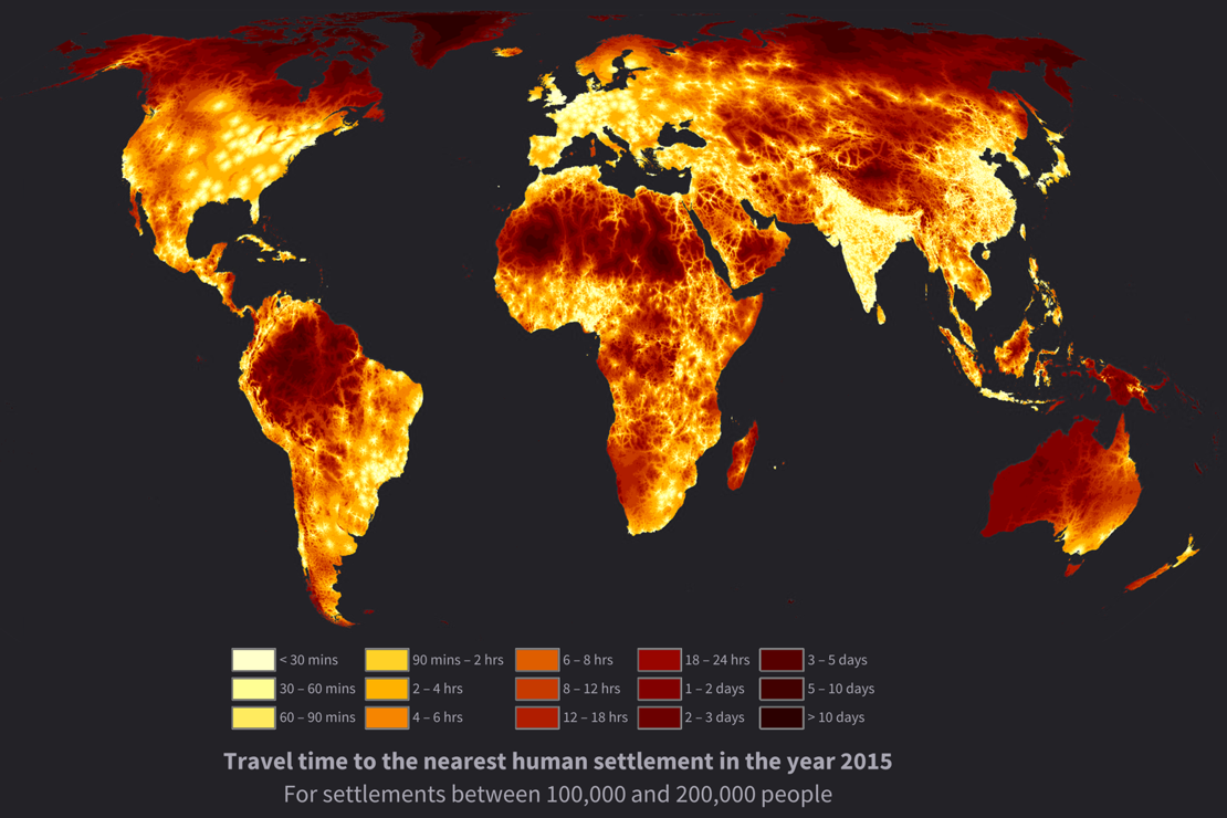
Description: Access to the resources, services and opportunities that are concentrated in cities is an important and frequently used indicator for rural development, agricultural productivity, access to markets for both food consumers and food producers and trade. Inequalities in access can lead to greater social and economic divides. Poorly planned expansions of transport networks can also degrade the natural environment, leading to deforestation and the over exploitation of easily accessed natural resources. On the other hand, well planned improvements in access can lead to better outcomes in rural health, wealth and economic livelihoods whilst limiting environmental impacts. To map the degree of access to resources and inequalities in access, ITC along with Oxford University and the Joint Research Centre of the European Commission built on previous work by Andy Nelson to develop a dataset on global travel times to the nearest city of 50,000 or more people and demonstrated negative relationships between rural wellbeing and travel time to these cities. Further work has developed multiple datasets to characterize travel time to cities of different size, to healthcare facilities, and catchment areas of cities and towns.
Sources: https://www.nature.com/articles/nature25181, https://www.nature.com/articles/s41597-019-0265-5, https://www.nature.com/articles/s41591-020-1059-1, https://www.pnas.org/doi/10.1073/pnas.2011990118
Partners: Oxford University, Google, Joint Research Centre of the European Commission, Food and Agriculture Organization of the United Nations (FAO)
Sponsor: Google, FAO
Contact: