The way remote sensing imagery, derived products, and spatial data are accessed and processed has evolved significantly. Traditionally, users relied on stand-alone desktop systems equipped with locally installed software to analyze and interpret data. Today, however, cloud-based platforms have become the norm. Data is now accessed directly from the cloud, and processing is performed using tools and services offered by cloud providers. After initial analyses, final products are typically downloaded and integrated with local datasets for comprehensive interpretation.
For this workflow, once the data is downloaded, ILWIS Open continues to be a valuable asset. ILWIS Open (Integrated Land and Water Information System) is a free and open-source Geographic Information System (GIS) and Remote Sensing software developed by ITC, University of Twente. It provides powerful tools for the input, management, analysis, and visualization of both spatial and non-spatial data. Originally designed for land and water management applications, ILWIS has grown into a full-featured GIS and remote sensing platform, combining raster and vector processing capabilities in one integrated environment. Its intuitive interface and broad range of analytical tools make it suitable for researchers, educators, and practitioners in fields such as agriculture, hydrology, environmental monitoring, and land use planning. ILWIS Open is particularly valued in academic and development contexts due to its accessibility, versatility, and ongoing support.
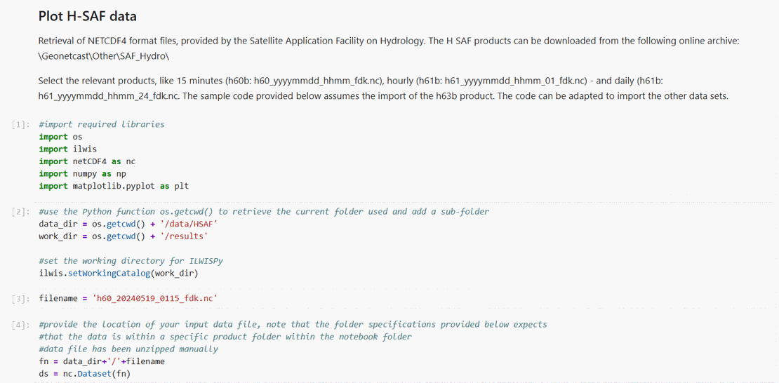
To align with these modern workflows, efforts were made to create, in addition to the desktop version of ILWIS, a Python-based API, resulting in the creation of ILWISPy. This Python extension brings ILWIS functionality into the Python ecosystem (compatible with Windows and Linux, Python ≥ 3.6), allowing users to leverage the full power of ILWIS alongside other Python libraries. Through ILWISPy scripting - particularly within Jupyter Notebooks - users can perform spatial analyses, visualize results, and generate output maps efficiently. This makes it a highly effective tool for both practical applications and educational purposes.
As shown in the figure below, ILWISPy can be imported and used within Jupyter Notebook environment and offers excellent opportunities for training and teaching.
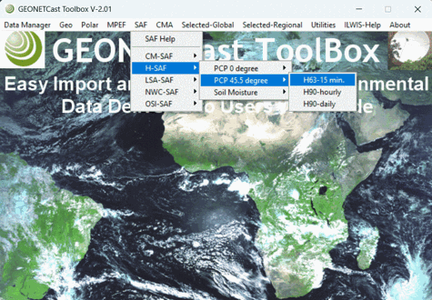 One practical application of ILWISPy is the GEONETCast Toolbox, a stand-alone package developed to import and preprocess diverse datasets delivered via the near real-time GEONETCast / EUMETCast data dissemination system. It facilitates import and pre-processing of various geostationary and METOP polar orbiting satellite information, as well as products on land, atmosphere and ocean.
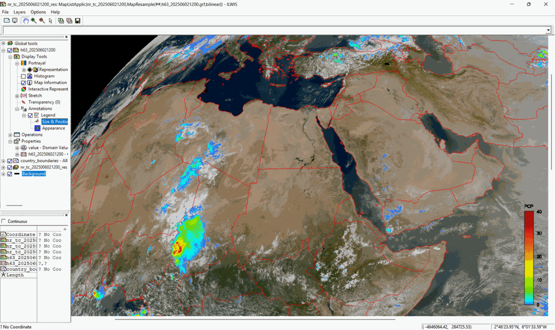
Below is an example from the toolbox, showcasing a dataset imported from the Satellite Application Facility on Hydrology. It displays a 15-minute rain rate product (in mm/hr), overlaid on a true-color composite from the Meteosat Third Generation (MTG) satellite, captured at the same time.