The Geospatial Computing Platform (GCP) is ITC’s state-of-the-art cloud-based interactive computing platform provided to its staff and students. The Center of Expertise on Big Geodata Science (CRIB) has developed and has been operating the platform since January 2021.
The platform is designed according to the results of a comprehensive status quo and user needs assessment study, and aims to serve self-learning, exploratory research, and education activities. It has more than 450 registered users with 15-50 users usually connected to the platform concurrently, who utilized more than 350,000+ hours of computation time as of September 2023.
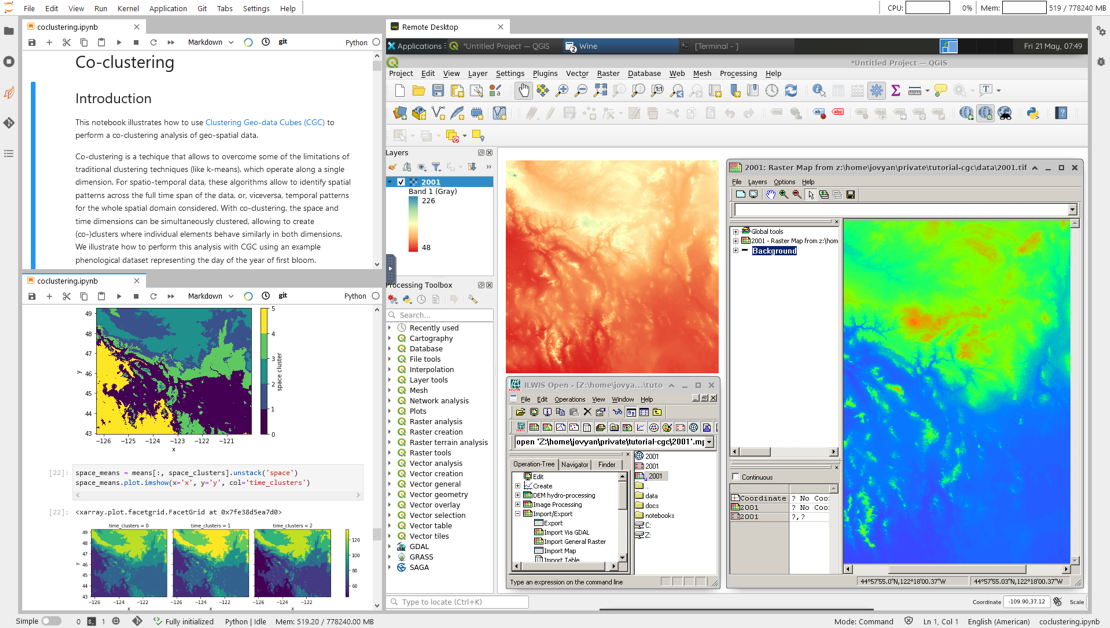
The platform provides a user-friendly interface for data analysis and visualisation with hundreds of ready-to-use scientific and geospatial analysis software packages, including desktop applications (e.g., QGIS). It is directly accessible by using a web browser and does not require registration or software installation. It features parallel, distributed, and GPU-enabled computing capabilities and replicated data storage. Each user has a private work environment, which they can customize according to their own needs. The platform also features public assets that are available to all users (e.g., global OSM data) and shared workspaces that allow collaborative work and data sharing among multiple users (e.g., research teams). Access can be granted to external users. Besides computing facilities, the platform also includes additional services, such as database and map servers, and code and data repositories.