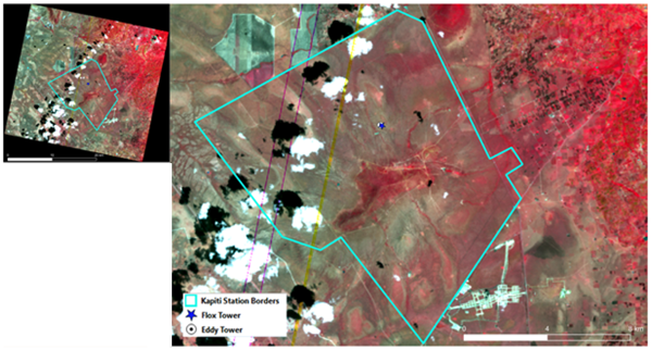
The study area of the project is centred around the Kapiti research station and nature conservancy, owned and managed by ILRI, which is located at 1.63°S, 37.14° E in Machakos County at an altitude of 1615-1920 m above sea level. The station spans an area of more than 13,000ha. It is in an arid and semi-arid land (ASAL) and largely consists of rangelands (grasslands, shrublands and open savanna woodlands).
Field Data
- Micrometeorological data: eddy covariance flux towers (cropland, rangeland) and lysimeter
- Ground-based hyperspectral measurements: FloX spectroradiometer


Earth Observation Data
- Italian Space Agency (ASI) PRISMA
- German Space Agency (DLR): ENMAP
- European Space Agency (ESA): Sentinel-2
- National Aeronautics and Space Administration-Jet Propulsion Laboratory (NASA-JPL) ECOSTRESS