harnessing the power of technology to automate the analysis and interpretation of large and complex spatial datasets—like satellite images, UAV data, and local sensor data
Geospatial artificial intelligence (GeoAI) is an exciting fusion of innovations in spatial science (GIScience) and big geospatial data with the rapid growth of methods in AI and machine learning helping us to increase our understanding of earth processes and support the development of solutions to better manage earth’s resources and ecosystems, improve our living environment and for example assess disaster risks. If you’re passionate about harnessing the power of technology to automate the analysis and interpretation of large and complex spatial datasets integrating, for example, remote sensing images, UAV data, citizen science and local sensor data, then GeoAI is the perfect theme for you.
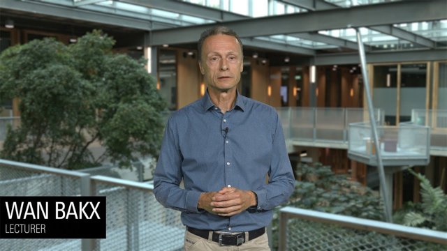
Video GeoAI explained
In this video, course coordinator Wan Bakx explains the Geospatial Artificial Intelligence (GeoAI) specialisation within the Master's in Geo-information Science and Earth Observation.

What is GeoAI?
The abundance of geospatial data, advanced remote sensing and GIS technologies, machine and deep learning algorithms and the wide variety and scales of geospatial problems require specialists and scientists with specific academic and technical skills. The GeoAI specialisation offers ample opportunity to develop the necessary skills that will enable you to leverage the latest technologies, like the application of drones/UAV and cloud computing, and algorithms like machine learning. The focus of this specialisation is on building a solid understanding of the suitability of machine and deep learning algorithms for specific geospatial problems using available big complex geospatial data sets that come from various sources, including citizen science, survey, GPS or satellite images. It comes without surprise that you develop appropriate scripting and programming skills to exploit and improve existing algorithms. In the end, you ensure that the generated geo-information is reliable and actionable.
Learning pathways
Under this specialisation, two predefined pathways exist. These pathways offer a coherent set of courses directed at a certain career path. Probably one of the available pathways in the programme will suit your needs. You can tailor some of the courses and choices in these pathways, but you should discuss this first with your mentor or study adviser.
What will you learn?
As a graduate of the Master's in Geo-Information Science and Earth Observation with a specialisation in GeoAI you have acquired specific, scientific knowledge, skills and values.
Other master's and specialisations
Is this specialisation not exactly what you are looking for? Maybe one of the other specialisations suits you better. You can also find out more about related Master’s at the University of Twente:
- Urban and Land Futures specialisation
- Disaster resilience specialisation
- Resource security specialisation
- Master’s in Spatial Systems & Society