Wunder News
Find here the newest Wunder updates
𝗗𝗮𝘁𝗮 𝘄𝗶𝘁𝗵 𝗗𝗶𝗿𝘁 𝗨𝗻𝗱𝗲𝗿 𝗜𝘁𝘀 𝗡𝗮𝗶𝗹𝘀
Proud to see @Voedselbos Glanerbeek (Jessica van Bossum Dagobert Bergmans Maud Aarts) share their perspective on our WUNDER work. Their new blog captures how we’re 𝗰𝗼-𝗯𝘂𝗶𝗹𝗱𝗶𝗻𝗴 𝗮 𝘀𝗼𝗶𝗹–𝗽𝗹𝗮𝗻𝘁 𝗱𝗶𝗴𝗶𝘁𝗮𝗹 𝘁𝘄𝗶𝗻 𝘄𝗶𝘁𝗵 𝘀𝘁𝗮𝗸𝗲𝗵𝗼𝗹𝗱𝗲𝗿𝘀—so models are grounded in real measurements, real management, and real decisions.
“𝗬𝗼𝘂 𝗰𝗮𝗻’𝘁 𝗹𝗼𝗼𝗸 𝗮𝘁 𝗽𝗹𝗮𝗻𝘁𝘀, 𝘀𝗼𝗶𝗹 𝗮𝗻𝗱 𝘄𝗮𝘁𝗲𝗿 𝘀𝗲𝗽𝗮𝗿𝗮𝘁𝗲𝗹𝘆.”
Together we’re linking in-field sensing (soil moisture at multiple depths, eddy covariance, radiometry, drones) with process models to understand water–energy–CO₂ exchanges and drought resilience. This partnership turns data into decisions—like smarter irrigation—while advancing open, reproducible science to improve soil and plant health in an evolving, sustainable manner.
Read the (NL) blog from Voedselbos Glanerbeek:
WUNDERbaarlijk onderzoek
(by Jessica Van Bossum)
8 oktober 2025

Beeld: WUNDER, Dagobert Bergmans
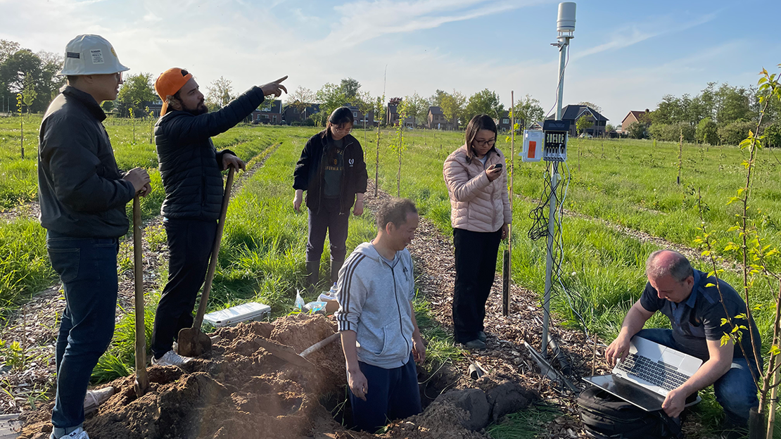
Er loopt een schare onderzoekers door het voedselbos. Van de UT (Universiteit Twente) maar we krijgen ook bezoek uit Wageningen, Delft en de HAS (Den Bosch). Al deze partijen werken in het WUNDER project samen aan een model om de uitwisseling van water, energie en CO2 tussen de bodem en de lucht beter te begrijpen. Dr. Yijian Zeng, universitair hoofddocent aan de UT, vertelt: Je kunt planten, bodem en water niet los van elkaar zien. We willen meer weten over de interacties tussen die drie: wat betekent dat voor de fotosynthese van de plant, opname van voedingsstoffen, uitwisseling van stoffen met de bodem en weerbaarheid in extreme omstandigheden? Het is de verwachting dat de water-, energie- en CO2-huishouding in een voedselbos stabieler is dan in andere landbouwsystemen, waar het bodemleven minder divers is; het voedselbos is dus beter bestand tegen droogte en andere weersextremen. Om dit te bewijzen, verzamelen de WUNDER-onderzoekers een enorme hoeveelheid meetgegevens: in twee voedselbossen en, ter vergelijking, een weiland en een akker.
De metingen in voedselbos Glanerbeek begonnen in 2023 met het plaatsen van twee weerstations die zonlicht, wind en neerslag meten. Daar wordt ook bodemvochtigheid en -temperatuur gemeten op vijf verschillende dieptes. Inmiddels zijn er twee neerslagmeters bijgekomen. In de sloten worden gootjes gelegd om te meten hoeveel water het bos in- en weer uit stroomt. Twee gootjes liggen er al; voor de overige twee is een vergunning aangevraagd bij het waterschap. Samen met de weerstations kan hiermee de waterkringloop in kaart gebracht worden.
In 2024 kwam een futuristische installatie bij die de uitwisseling van CO2, waterdamp en warmte meet tussen de bodem en de lucht: het ‘Eddy Covariantie Systeem’. Daarnaast staat een ‘4-componenten netto radiometer’, die meet hoeveel zonnestraling en warmtestraling er binnenkomt en weer teruggekaatst wordt – ofwel, de energie-uitwisseling tussen de bodem en de lucht. In de bodem wordt de warmtestroom gemeten met de welluidende ‘Hukseflux’-platen. Satellietbeelden geven informatie over de hoogtegroei. Daarnaast worden er drone-beelden gemaakt boven het voedselbos, waarop ook de warmtestraling te zien is.
Elke twee weken meten Ting, Enting en Zengjing, drie doctoraalstudenten, op een aantal plekken het bladoppervlak, de hoogtegroei en het vochtgehalte in de begroeiing. Deze zomer bivakkeerden ze een maand lang in de buurt van het voedselbos, om overdag én ’s nachts de sapstroom, verdamping en uitademing van drie elzen en een nashiperenboom te meten. Want, vertellen ze, planten hebben een dag- en nachtritme. Deze zomer sloeg de paniek toe toen de apparatuur geen metingen gaf. Wat bleek: het was boven de 33°C; dan stopt de sapstroom in de plant! Ook de rol van het bodemleven wordt onderzocht: zo wordt met high-tech ringen in de grond de uitademing van CO2 gemeten. Het team kweekt ook een paar voedselbosplanten op in een kas, om daar te kunnen bestuderen hoe deze reageren op veranderingen in water en voedingsstoffen. Met de meetgegevens wordt een ‘digitale tweeling’ van de boompjes gemaakt, waarmee onderzoekers de wisselwerking tussen plant- en bodemgezondheid kunnen bestuderen onder verschillende omstandigheden.
De gegevens van alle onderzoekers worden in een ingewikkeld computermodel aan elkaar geknoopt. Dat model moet meer inzicht geven in hoe planten en het bodemleven omgaan met warmte, droogte, nattigheid en andere omstandigheden. Die inzichten kunnen boeren helpen bij afwegingen over water geven en het verbeteren van plant- en bodemgezondheid. Veel van het onderzoek gaat ons boven de pet. Maar de meetgegevens over bodemvochtigheid zijn nu al bruikbaar om onze beregening op af te stemmen.
Meer lezen over het onderzoek? Hier zijn de verschillende wetenschappelijke artikelen te vinden die het WUNDER team heeft gepubliceerd.

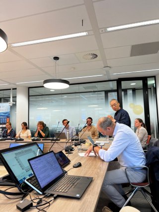
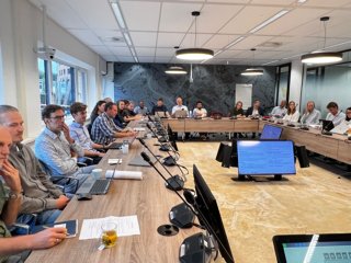
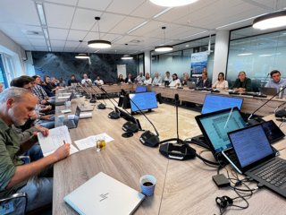
NL Drought Meeting
In the context of the WUNDER, PCP-WISE, and Kennis Netwerk Water projects, the NL Drought Meeting was jointly organised under the initiative of Prof Bob Su & Assoc. Prof Yijan Zeng, together with the Waterschapshuis (Jeroen de Bruin) in Amersfoort and STOWA/SAT-WATER (Chair/Secretary Hans van Leeuwen).
Purpose & aim: Bring together water authorities, KNMI, and research groups on drought to work together and address the key challenges of remote sensing-based drought monitoring (soil moisture, evapotranspiration & irrigation) for enhanced water management in the Netherlands. We aim to have a better understanding of the drought monitoring capacity in the NL, and how to bring synergies between currently ongoing projects, operations, existing networks, etc., for resilient drought management.
Relevant conclusions/findings after discussions with the group could be summarised as:
· The current SAT-WATER/WIWB Waterschapshuis (procurer to the market) national products which are operationally introduced to the water authorities like ET_act, Soil Moisture, Rainfall (IRC) are a first important step for building a national interoperable dataset for monitoring our water balance. It provides spatiotemporal insights/indications of trends within and between our water management areas, as well as cross-border areas. The evaluation of the quality of these datasets is a continuous point of attention and presents challenges for improvement through collaboration between water authorities and the research community.
· The WUNDER project is a great example of simulating the Soil-Water-Vegetation- Atmosphere system with a biophysically-based digital twin model (Stemmus-Scope), which is then calibrated and validated with remote sensing and in-situ observations. With such a physically consistent soil-plant digital twin framework, we are able to monitor the propagation of drought and evaluate the impacts of and responses to drought in agriculture and natural ecosystems.
· The KNMI has the ambition to improve the drought (early) warning mechanism by enhancing its traditional in-situ meteorological measurement infrastructure by also introducing hydrological in-situ information (e.g., measurements of soil moisture content and actual evaporation). These HydroMet mechanisms require close future cooperation between the water sector, meteorology, and citizens.
· Important contribution was given by Vechtstromen representing the water authorities, where a common groundwater and water balance monitoring (scaling, climate aspects) strategy on regional (Waterschappen) and national (Water Management Centre RWS) is required for (near) future climate adaptation operations. A need for common interoperability and acceptance for a joint national assessment of our water conditions (including water distribution) is clearly needed. Therefore, national initiatives such as the SAT-WATER/WIWB/NHI operational (‘standardised’) information production and maintenance (including archiving) performed by the Waterschapshuis and supported by the water authorities and Research communities (e.g., KNMI, Deltares, Universities) are of central importance. (Pieter Fillius asked for support for a TKI initiative on this topic)
· In the afternoon, interesting research was presented on the relevance of ETact and ETpot for vegetation/crop performance monitoring, also the intercomparison between ETact and the ETref, both of which are relevant for drought monitoring and serve as drought indicators from both hydrology and meteorology perspectives (when combined with soil moisture measurements). It highlights the need for a more integrated approach (e.g., as the HydroMet mechanism mentioned above). Such integrated measurements show the close relationship between water balance and vegetation physiology through root water uptake, transpiration, and photosynthesis (see a new editorial on this topic), as well as their interaction with groundwater through the rooting zone.
· After productive discussions, it was suggested and agreed that:
The KNW and stakeholders offer to enable and stimulate cooperation between research entities (universities, GTIs, STOWA), water organisations, and the market. An important suggestion for quality improvement is to establish a validation network with water authorities and research organisations. Practical research and in-situ mechanisms/projects require alignment and operational cooperation. A framework plan will be developed, supported by the PhD and Post-Doc researchers active in the WUNDER, PCP-WISE, and KNW-Water projects.
Appendix 1: The agenda of NL Drought Meeting
Location: Room 1.30 (IJssel), het Waterschapshuis, Stationsplein 89, 3818 LE Amersfoort
Date/Time: 18 September 2025, 9:30-16:30
09:30-09:50 walk in (coffee & tea)
09:50-10:00 Welcome (Hans van Leeuwen- STOWA, Bob Su-UTwente)
Session1: NL Drought Monitoring Capacity (chair: Hans van Leeuwen)
10:00-10:40 SATDATA/LIBV (Jeroen de Bruin -hWh, Bart Moekestorm-Hydrologic)
10:40-11:20 WUNDER/KNW-Drought/PCP-WISE (Yijian Zeng, Bob Su, UTwente)
11:20-12:00 KNMI Drought Monitoring (Gerard van der Schrier, KNMI)
12:00-12:30 Groundwater Monitoring for Drought Management (Pieter Filius, Vechtstromen)
12:30-13:30 Lunch Break & Posters
Session2: Essential Variables for Drought Monitoring
Session2a (chair: Frank van der Bolt)
13:30-14:10 Precipitation shortage for monitoring drought and decision making: actual versus potential? (Qianqian Han, UTwente)
14:10-14:50 Evapotranspiration: actual versus reference? (Liduin Bos Burgering – Deltares/TUDelft, Enting Tang-UTwente, Prajwal Khanal-UTwente)
14:50-15:20 Coffee/Tea Break & Posters
Session2b (chair: Wouter van Eck)
15:20-16:00 Soil moisture for drought monitoring and management: surface versus rooting zone? (Yijian Zeng, UTwente)
16:00-17:00 Drinks and Snacks & Posters
|
|
| |
| |

Photosynthesis and water potential: a new perspective for coupling water, energy, and carbon cycles
Photosynthesis and water potential A new perspective for coupling water, energy, and carbon cycles. This study present a framework centered on the soil-plant system, leveraging Earth Observation to close the water cycle and integrate it with energy and carbon dynamics, with photosynthesis and water potential as the unifying mechanism.
Read more: https://www.the-innovation.org/article/doi/10.59717/j.xinn-geo.2025.100156

Keeping Soil Healthy: Why It Matters and How Science Can Help
Healthy soils are vital for sustaining life on Earth. They are essential for ecosystems, agricultural production, and clean water, and even help to regulate climate.
Healthy soil—the living foundation of food production, clean water filtration, and climate resilience—directly sustains agricultural productivity. To protect and improve these irreplaceable ecosystem services, scientists now employ advanced monitoring methods, combining ground-level assessments with remote sensing technologies, ensuring we safeguard soil’s multifaceted roles for future generations. Credit: Bob Su
A new article in Reviews of Geophysics explores the latest scientific methods for monitoring soil health, including innovative tools like digital twins and satellite-enabled programs, while highlighting persistent gaps in linking indicators to soil functions across scales. Here, we asked the authors to give an overview of the topic.
What is soil health, and how is it different from soil quality?
A healthy soil is a thriving ecosystem: it feeds plants, filters water, stores carbon, and supports worms, microbes, and other tiny lifeforms.
Think of soil health as the soil’s ability to “stay alive” and do its job. A healthy soil is a thriving ecosystem: it feeds plants, filters water, stores carbon, and supports worms, microbes, and other tiny lifeforms. Soil quality, on the other hand, usually refers to how good soil is for growing crops. Soil health is the bigger picture—it’s about keeping soil thriving not just for farms, but for nature and our planet.
Why does soil health matter?
Healthy soil is a multifunctional linchpin of terrestrial ecosystems. It secures food production by nurturing crops, acts as a natural water filter by retaining pollutants, and serves as a massive carbon sink, sequestering atmospheric CO₂ to mitigate climate change—a process monitored at continental scale through EU’s initiatives such as LUCAS, which tracks soil carbon through satellite and field data. Simultaneously, it harbors diverse subterranean communities, from bacteria to earthworms, that drive nutrient cycling and enhance ecosystem resilience against droughts, floods, and pathogens.
How do we measure soil health?
Scientists assess three core dimensions:
- Physical properties: Structure (e.g., root penetration, water retention).
- Chemical properties: Nutrient availability and pH balance.
- Biological properties: Microbial and macrofaunal activity (e.g., decomposition rates).
Emerging tools, such as satellite spectral imaging and AI-driven digital twins, integrate landscape-scale data (e.g., erosion patterns, vegetation cover) to contextualize field measurements. However, challenges persist in scaling microscale processes (e.g., nutrient cycling) to predict landscape-level outcomes.
Why are soil microbes so important?
Soil microbial communities (bacteria, fungi, archaea) are indispensable biogeochemical agents. They decompose organic matter, recycle nutrients, and secrete substances that stabilize soil aggregates, reducing erosion. Microbial communities also suppress plant pathogens and form symbiotic relationships with roots, enhancing crop resilience. Their absence leads to soil degradation, compromising biophysical integrity and triggering cascading declines in ecosystem functionality.
How does water affect soil health?
Water is the lifeblood of soil ecosystems.
Water is the lifeblood of soil ecosystems. Optimal moisture sustains plant hydration and microbial activity. Excess water, however, induces hypoxia, impairing root respiration and promoting anaerobic processes like methanogenesis. Prolonged drought destabilizes soil structure, increasing erosion risks. Healthy soils counteract these extremes through stable aggregates and organic matter, acting like sponges to store water during droughts and absorb rainfall during floods.
Can satellites truly monitor soil health?
Yes. Programs like the EU’s LUCAS integrate satellite data (e.g., Copernicus Sentinel-2’s multispectral imaging for organic carbon) with ground surveys—more than 100,000 soil samples collected between 2009 and 2022 for physical, chemical, and biological analysis. This hybrid approach identifies degraded zones, evaluates restoration efforts, and scales localized data (e.g., nutrient cycles) to landscape processes. These datasets also feed into digital twins, enabling predictive models that inform policies like the EU Soil Monitoring Law.
What’s a “digital twin” for the soil-plant system?
A digital twin is a dynamic, computer-based replica of a physical system – in this case, the soil-plant-environment continuum. It simulates critical processes like water, nutrient, and energy flows (e.g., using models like STEMMUS-SCOPE) and continuously improves its accuracy by assimilating real-time sensor data. This creates a virtual laboratory where we can test responses to challenges like drought or pollution without risking real ecosystems. While the concept originated in aerospace, digital twins now drive major initiatives like the EU’s Destination Earth for modeling climate extremes. Leveraging recent advances in AI and satellite data, we can now perform continent-scale soil health monitoring and scenario modeling, optimizing and transforming land management practices.
What critical gaps remain in our understanding of soil health?
Safeguarding soil health is not just an ecological imperative but a cornerstone of humanity’s future.
Key unknowns include feedback loops between soil structure and microbial communities, scaling microscale processes (e.g., nutrient cycling) to landscapes, and predicting climate impacts on soil carbon and microbial symbioses. Practical hurdles include fragmented global datasets, limited integration of microbial traits in models, and cost-effective tools for farmers. Collaborative platforms like the EU Soil Observatory bridge research and policy, but challenges like modeling root-water-nutrient dynamics in heterogeneous soils or fusing satellite-ground data persist. Addressing these gaps requires interdisciplinary innovation—an urgent task, as safeguarding soil health is not just an ecological imperative but a cornerstone of humanity’s future.
—Yijian Zeng (y.zeng@utwente.nl, ![]() 0000-0002-2166-5314), University of Twente, Enschede, The Netherlands; and Bob Su (
0000-0002-2166-5314), University of Twente, Enschede, The Netherlands; and Bob Su (![]() 0000-0003-2096-1733), University of Twente, Enschede, The Netherlands
0000-0003-2096-1733), University of Twente, Enschede, The Netherlands
Editor’s Note: It is the policy of AGU Publications to invite the authors of articles published in Reviews of Geophysics to write a summary for Eos Editors’ Vox.
Citation: Zeng, Y., and B. Su (2025), Keeping soil healthy: why it matters and how science can help, Eos, 106, https://doi.org/10.1029/2025EO255016. Published on 29 May 2025.
Role of DST in Drought Management in the Netherlands
A new WUNDER paper has been published:
The role of decision support tools in drought management: Insights from the Netherlands

Abstract: Droughts have an increasing impact on the entire European continent. As the frequency and intensity of droughts rise in many parts of Europe, the implementation of effective drought adaptation and mitigation strategies becomes increasingly important. However, it is not known how diverse tools are used in drought management with increasing drought severity. This study explores the role of Decision Support Tools (DSTs) in strategic and operational drought management in the Netherlands. Through a survey among national and regional water authorities, this study shows the increasing reliance of water managers on field measurements, Data Information Systems (DISs), stakeholder consultation, and legislation with increasing drought severity. Weather forecasts and expert knowledge remain important throughout all drought management phases. Despite the increased use of DISs with drought severity, the use of hydrological models does not follow the same trend. DISs, which often incorporate hydrological models, reveal a ‘hidden’ use of these models. Rather than serving as ‘key artifacts’ for modelers, they become active ‘participants’ in broader data systems during advanced phases of drought management. All these aspects influence key responsibilities in model use including appropriateness and transferability, reproducibility, and transparency. These factors are critical to consider when aiming to bridge the gap between science and policy in the application and development of DSTs.
More details: https://www-sciencedirect-com.ezproxy2.utwente.nl/science/article/pii/S1462901125000814?via%3Dihub
Fourth WUNDER Newsletter
Please click here for the latest WUNDER newsletter.
Third WUNDER Newsletter Issued
Some activities and achievements in the past half-year.
Please download the WUNDER Newsletter here.
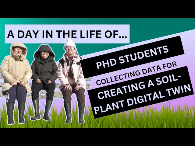
A DAY IN THE LIFE OF... PhD students collecting data for creating a soil-plant digital twin
Fieldwork. No matter how well-prepared you come and how well-defined your step-by-step procedures are, there will always be some challenges. In this ‘Day in the Life of’, we follow three PhD students in their pursuit of collecting data for the creation of a soil-plant digital twin. What is a soil-plant digital twin? How do they cope with the wild circumstances thrown up by the wet weather? What parameters are they collecting data on? And how do they ensure consistent data collection?
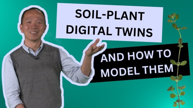
Geoversity Interview: Soil-Plant Digital Twins and How to Model Them
Imagine predicting how our vegetation responds to environmental changes like droughts or heavy rains. It could help us take steps to prevent crop failure and loss of productivity – more pressing than ever, given the impact of climate change on food security and our ecosystems. With soil-plant digital twins, researchers aim to achieve just this! Dr Yijian Zeng unveils how these virtual copies of real-world soil-plant systems can offer insights into how predicted weather will affect vegetation health in the real world. Learn how they can inform farmers to make better decisions about irrigation, fertilization, and crop management - ultimately improving yield and sustainability. In this video, Dr. Yijian Zeng talks about what it takes to build the model, the unknowns he wishes to answer, and how the project has already made a practical impact in his neighborhood.
A Digital Twin of the Soil-Plant-Atmosphere Continuum Augmented with Earth Observation (SPACEO)
The Digital Twin Earth (DTE) is a rapidly evolving concept, approach, and technology fueling the development of Earth system science. A digital twin of the soil-plant-atmosphere continuum (SPAC) augmented with Earth Observation (SPACEO) consists of three pillars: EO-collected data, the capability for assimilating such data (i.e., data assimilation), and a digital replica of the SPAC system.
The soil-plant hydraulic connection is regulated by water potential gradients across the soil-root-stem-leaf-atmosphere interfaces, which are influenced by the cloud-radiation interaction. Clouds reflect, absorb, and scatter part of the solar radiation; the rest reaches the Earth’s surface and activates the photosynthetic process through photosynthetically active radiation (PAR). Together with PAR and other meteorological variables, soil-plant hydraulics modulate leaf water potential, which in turn influences photosynthesis and leaf gas exchange. Changes in CO2 and water vapor at a cellular scale determine the fluxes of water, energy, and carbon. These cellular-scale processes will provide feedback to the cloud formation at the mesoscale via land surface water-energy-gas fluxes (e.g., latent and sensible heat fluxes) and volatile organic compounds that can serve as water vapor condensation nuclei for cloud formation.

More details can be found: Zeng Y and Su Z. Digital twin approach for the soil-plant-atmosphere continuum: think big, model small. Front Sci (2024) 2:1376950. doi: 10.3389/fsci.2024.1376950
Second WUNDER Newsletter Issued
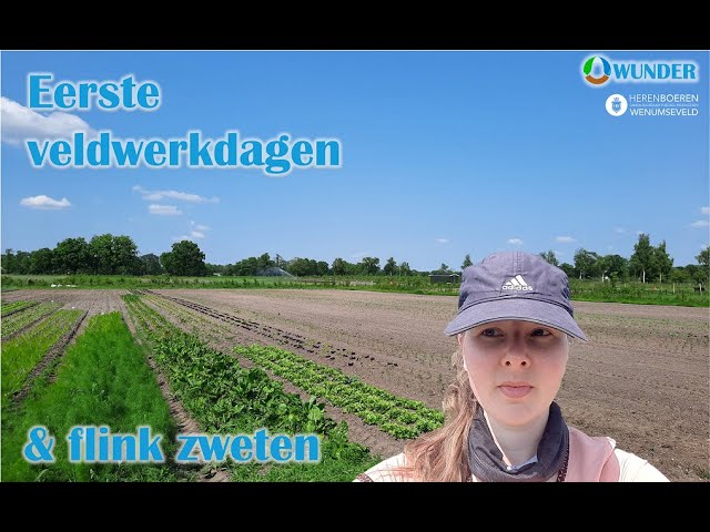
VLOG#1 WUNDER FIELDWORK AT WENUMSVELD by Liduin Bos-Burgering
WUNDER in Actions with Drought Knocking at the Door
With a little falling rain and steady raising air temperature, the continuous sunny weather cheers up outdoor activities in the past weeks. However, the combined effect of heat and lack of rainfall sends an omen to the Netherlands that Drought is knocking at its door again.
Rijkswaterstaat instituted heat protocol (air temperatures >30 ) on 10 June 2023, and NRC article on 31 May 2023 (‘Opwarmende bodem is slecht nieuws voor natuur én landbouw’) alarms the warming-up of soil in the Netherlands due to climate change. The top 100 cm soil temperature increased by an average of 1.5 ℃ over the past 40 years and will continue to rise by 1.2 ℃ in the next 30 years, as a result of the increase in air temperature.
The rising soil temperature has negative effects on soil-plant health, with increased mineralization of soil carbon and soil respiration (thus increased CO2 emissions), reduced absorption of water and nutrients by roots, as well as declined root-shoot growth. The water distribution in the soil is very heterogeneous, and plant roots can compensate for drier soil layers by sucking more water from wetter layers. However, such a water compensation mechanism can be impeded by rising soil temperature, causing damage to plants, reducing leaf stomatal conductance and photosynthesis, and eventually leading to reductions in plant productivity and yield.
The alertness of the above negative effects demands urgent actions to monitor the soil temperature, soil moisture, and meteorological situations across the Dutch landscapes. WUNDER had installed 9 stations since May 18, spanning a gradient of ecosystems across the Netherlands: a sapling food forest in Glanerbeek, a matured food forest in Ketelbroek, a natural forest in Speulderbos, an ecological farming site in Wenumseveld, and a ryegrass field in De Horst. These stations will help us to track the effects of compound drought and heat events on Dutch ecosystems.

Figure 1 WUNDER Stations deliver real-time data across the ecosystem gradient of the Netherlands.
THE PULSE OF YOUR FIELDS AT YOUR FINGERTIP
May 18, 2023, the WUNDER team installed two weather stations and four soil moisture/temperature stations at Voedselbos Glanerbeek (founders: Maud Aarts, Dagobert Bergmans en Jessica van Bossum). These stations will provide time series of soil moisture and temperature (at depths of 2.5cm, 5cm, 10cm, 20cm, 40cm, and 80cm), solar radiation, air temperature, vapor pressure (deficit), atmospheric pressure, wind speed (direction), precipitation, and lightning activity (counts). The data loggers transmit data every hour, so that the measurements can be accessed on the could platform. Researchers and farmers can monitor the conditions of the fields on their computers and smartphones.
Please see below some figures and photos for inspiration.

Figure 1. Weather and soil moisture and temperature stations are operational at Voedselbos Glanerbeek
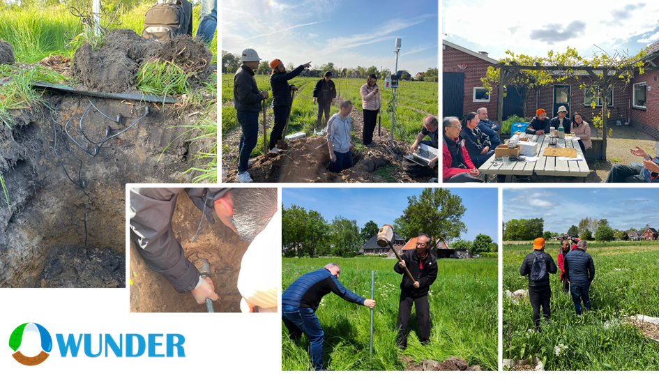
Figure 2 Some impressions of the very successful fieldwork.
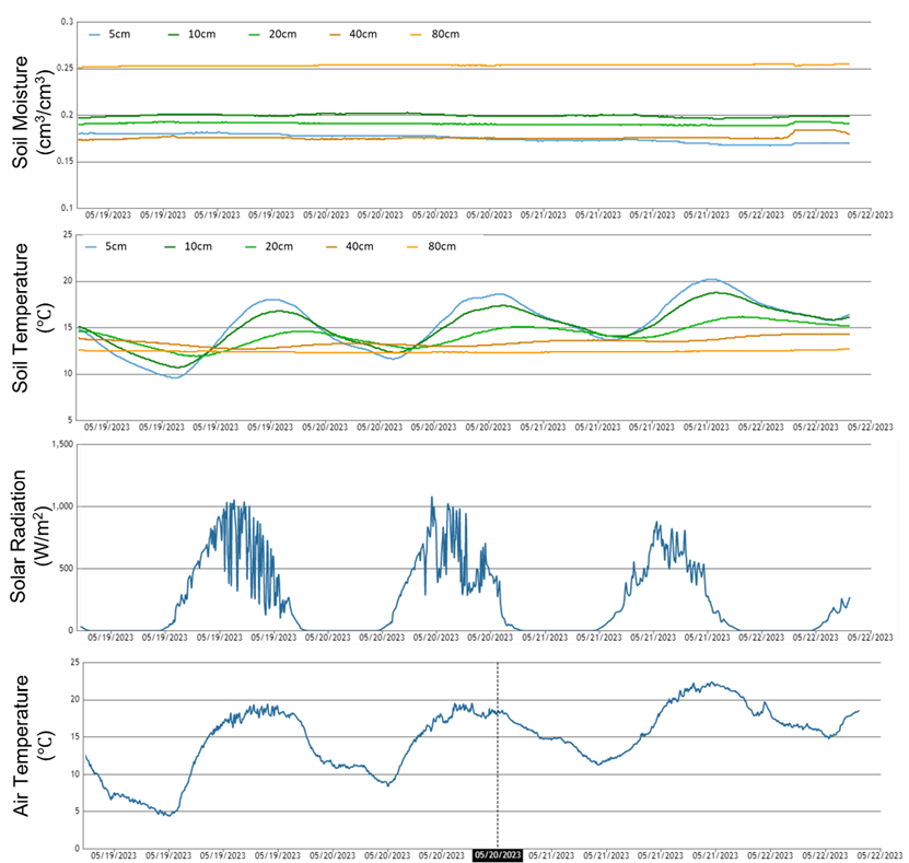
Figure 3 Some data examples of the operational stations.
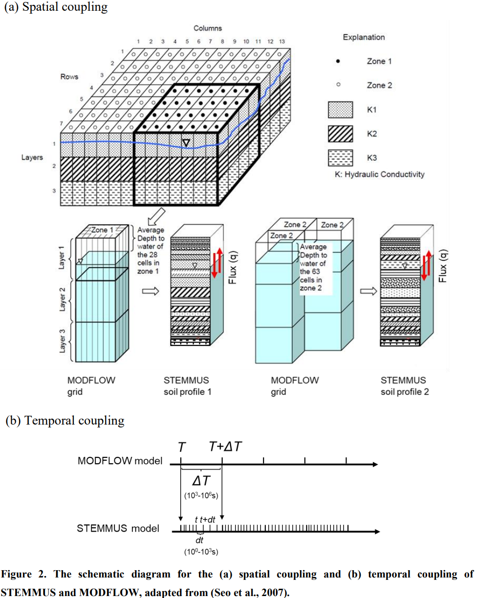
STEMMUS-MODFLOWv1.0.0 IS NOW OPENED FOR DISCUSSION
How to efficiently and physically integrate the soil water dynamics with groundwater flow processes has drawn much attention. We present a coupled soil water-groundwater model, considering the two-way feedback coupling scheme, and verified its performance using two synthetic cases (using the fully 3D variably saturated flow (VSF) model simulations as the ‘reference’) and one real catchment case (using the groundwater table depth and soil moisture profile measurements). By the cross-validation between the observations and various model simulations, the two-way coupling approach is proven physically accurate and is applicable for large-scale groundwater flow problems. Compared to the simulation by groundwater model alone (i.e., only MODFLOW), the coupling of MODFLOW with one soil column reduced the overestimation of groundwater table simulation (taking the VSF model simulations as the reference). The results were further improved as more soil columns were used to represent the heterogeneous soil water-groundwater interactions. Compared to the HYDRUS-MODFLOW, the two-way coupling approach produces a similar spatial distribution of hydraulic heads while better performs in mimicking the temporal dynamics of groundwater table depth and soil moisture profiles. We attribute the better performance to the different coupling strategies across the soil-water and groundwater interface. It is thus suggested to adopt the two-way feedback coupling scheme, together with the moving phreatic boundary and multi-scale water balance analysis, to maintain physical consistency and reduce coupling errors. The realistic implementation of the vadose zone processes (with STEMMUS), coupling approach, and spatiotemporal heterogeneity of soil water-groundwater interactions were demonstrated critical to accurately represent an integrated soil water-groundwater system. The developed STEMMUS-MODFLOW model can be further equipped with different complexities of soil physics (e.g., coupled soil water and heat transfer, freeze-thaw, airflow processes), surface hydrology (snowfall, runoff), soil and plant biogeochemical processes, towards an integrated "from bedrock to atmosphere" modeling framework.
Please click the link for posting your comments: https://gmd.copernicus.org/preprints/gmd-2022-221/
WUNDER TEAM @ EGU (APR. 23-28, 2023, VIENNA, AUSTRIA)
We will present our latest works at EGU with the following abstracts:
- Yu, D., Zeng, Y., Wang, Y., and Su, B.: Integrated modeling of radiation transfer, plant growth, and the movement of soil moisture in the soil–plant–atmosphere continuum (STEMMUS–SCOPE-WOFOST v1.0.0), EGU General Assembly 2023, Vienna, Austria, 24–28 Apr 2023, EGU23-2531, https://doi.org/10.5194/egusphere-egu23-2531, 2023
- Tang, E., Zeng, Y., Wang, Y., Song, Z., Yu, D., Wu, H., Qiao, C., van der Tol, C., Du, L., and Su, Z.: Understanding the Effects of Revegetated Shrubs on Energy, Water and Carbon Fluxes in a Semiarid Steppe Ecosystem Using STEMMUS-SCOPE Model, EGU General Assembly 2023, Vienna, Austria, 24–28 Apr 2023, EGU23-2749, https://doi.org/10.5194/egusphere-egu23-2749, 2023.
- Wang, Y., Zeng, Y., Alidoost, F. (., Song, Z., Yu, D., Tang, E., Han, Q., Bas, R., Serkan, G., van der Tol, C., and Su, Z. (.: STEMMUS-SCOPE for PLUMBER2: Understanding Water-Energy-Carbon Fluxes with a Physically Consistent Dataset Across the Soil-Plant-Atmosphere (SPAC) Continuum, EGU General Assembly 2023, Vienna, Austria, 24–28 Apr 2023, EGU23-16633, https://doi.org/10.5194/egusphere-egu23-16633, 2023.
- Alidoost, F., Liu, Y., Schilperoort, B., Su, Z., and Zeng, Y.: Accelerating the understanding of plant response to drought stress, EGU General Assembly 2023, Vienna, Austria, 24–28 Apr 2023, EGU23-6416, https://doi.org/10.5194/egusphere-egu23-6416, 2023.
- Khanal, P., van Dijke, A. H., Zeng, Y., and Orth, R.: Near-surface vs. sub-surface soil moisture impacts on vegetation functioning, EGU General Assembly 2023, Vienna, Austria, 24–28 Apr 2023, EGU23-7670, https://doi.org/10.5194/egusphere-egu23-7670, 2023.
- Zeng, Y., Alidoost, F., Schilperoort, B., Liu, Y., Willem Grootes, M., Wang, Y., Song, Z., Yu, D., Tang, E., Han, Q., van der Tol, C., Zurita-Milla, R., Yang, M. Y., Girgin, S., Dzigan, Y., and Su, Z.: Towards an Open Digital Twin of Soil-Plant System Following Open Science , EGU General Assembly 2023, Vienna, Austria, 24–28 Apr 2023, EGU23-9786, https://doi.org/10.5194/egusphere-egu23-9786, 2023.
WUNDER TEAM @ NAC-GEO (MAR. 23-24, 2023, NWO, UTRECHT)
- Danyang Yu, Yijian Zeng, Yunfei Wang, and Bob Su, Integrated modeling of radiation transfer, plant growth, and the movement of soil moisture and heat in the soil–plant–atmosphere continuum (STEMMUS–SCOPE-WOFOST v1.0.0), NAC-GEO 2023, Utrecht, the Netherlands
- Enting, Tang, Yijian Zeng, Yunfei Wang, Zengjing Song, Danyang Yu, Hongyue Wu, Chenglong Qiao, Christiaan van der Tol, Lingtong Du, and Zhongbo Su, Understanding the Effects of Revegetated Shrubs on Energy and Water Fluxes in a Semiarid Steppe Ecosystem Using STEMMUS-SCOPE Model, NAC-GEO 2023, Utrecht, the Netherlands
- Yijian Zeng, Fakhereh Alidoost, Bart Schilperoort, Yang Liu, Meiert Willem Grootes, Yunfei Wang, Zengjing Song, Danyang Yu, Enting Tang, Qianqian Han, Christiaan van der Tol, Raúl Zurita-Milla, Michael Ying Yang, Serkan Girgin, Yifat Dzigan, and Zhongbo Su, Towards an Open Digital Twin of Soil-Plant System Following Open Science, NAC-GEO 2023, Utrecht, the Netherlands
ITC - GEOHERO INTERVIEW ON SOIL-PLANT DIGITAL TWIN
QIANQIAN HAN PUBLISHED THE "IN-SITU OBSERVATION CONSTRAINED GLOBAL SURFACE SOIL MOISTURE PRODUCTS AT 1KM" ON SCIENTIFIC DATA
Han, Q., Zeng, Y., Zhang, L. et al. Global long term daily 1 km surface soil moisture dataset with physics informed machine learning. Sci Data 10, 101 (2023). https://doi.org/10.1038/s41597-023-02011-7
Abstract: Although soil moisture is a key factor of hydrologic and climate applications, global continuous high resolution soil moisture datasets are still limited. Here we use physics-informed machine learning to generate a global, long-term, spatially continuous high resolution dataset of surface soil moisture, using International Soil Moisture Network (ISMN), remote sensing and meteorological data, guided with the knowledge of physical processes impacting soil moisture dynamics. Global Surface Soil Moisture (GSSM1 km) provides surface soil moisture (0–5 cm) at 1 km spatial and daily temporal resolution over the period 2000–2020. The performance of the GSSM1 km dataset is evaluated with testing and validation datasets, and via inter-comparisons with existing soil moisture products. The root mean square error of GSSM1 km in testing set is 0.05 cm3/cm3, and correlation coefficient is 0.9. In terms of the feature importance, Antecedent Precipitation Evaporation Index (APEI) is the most important significant predictor among 18 predictors, followed by evaporation and longitude. GSSM1 km product can support the investigation of large-scale climate extremes and long-term trend analysis.

WUNDER-AIOS' BIWEEKLY MEETING
AIOs for WUNDER gathered every two weeks to share with each other research activities, discuss technical issues, and to cross-connect different WPs activities.


FIRST WUNDER NEWSLETTER ISSUED
Please find below the first WUNDER newsletter by Bob:
Click here to download.
WE KICK-OFF NWO-KIC WUNDER PROJECT AT KETELBROEK VOEDSELBOS
WUNDER project kicked off on 02-Sep-2022, with a physical tour to Ketelbroek Voedselbos guided by Wouter van Eck, who has thousands of stories for almost everything in food forestry. WP1-WP4 discussed the proposed research content and the implementation plan. WP5 had a dedicated kick-off meeting at Wageningen.

WUNDER in news
- https://www.itc.nl/news/2022/3/479520/nwo-kic-grant-to-ut-research-on-water-use-during-droughts
- https://www.utoday.nl/news/71099/-15-million-for-ut-research-to-mitigate-drought-damage
- https://www.h2owaternetwerk.nl/h2o-actueel/wunder-project-onderzoekt-watergebruik-bij-extreme-droogte
- https://www.utwente.nl/en/research/themes/resilient/news-and-events/newsletter-v1/wunder-project/