The rising global demand for affordable vegetable oils has accelerated the expansion of oil palm cultivation into ecologically sensitive areas, particularly along riverbanks. Although oil palm plantations have long been recognized as a major contributor to deforestation, their unauthorized establishment in riparian zones remains significantly underreported. This MSc research aimed to create a reliable methodology for mapping and tracking oil palm plantations in riverine environments utilizing open-access datasets, including satellite imagery, existing oil palm distribution maps, and hydrological datasets. The resulting information could prove valuable for regulatory enforcement and ecological restoration initiatives.
The Indonesian Riau, known as the largest palm oil-producing region, was selected as the study area (Figure 1).
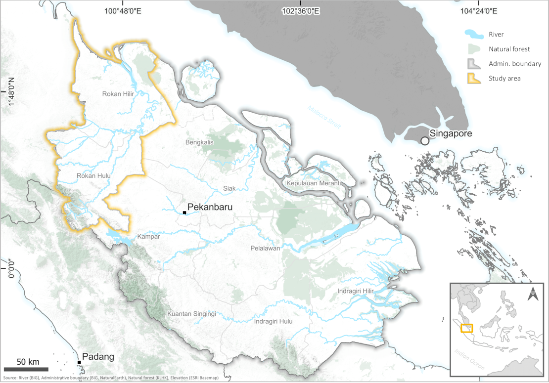 Figure 1.Study area map of Riau, Indonesia
The tropical climate characteristic of oil palm cultivation areas presents persistent cloud coverage that frequently constrains the application of optical satellite sensors for remote sensing analysis. To address this limitation, Sentinel-1 Synthetic Aperture Radar (SAR) imagery was utilized, offering superior cloud penetration capabilities.
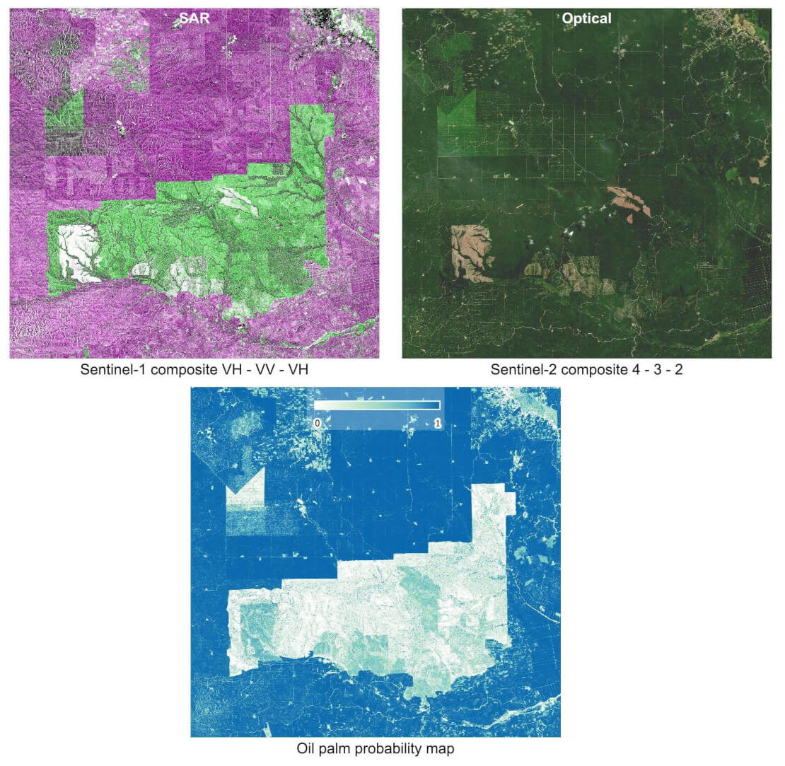
Figure 2: Comparison of Sentinel-1 SAR and Sentinel-2 optical image appearance, and model output.
An existing publicly available oil palm dataset served as ground truth labels for training a neural network classifier using SAR data, with performance compared against an identical model trained on Sentinel-2 optical imagery. Results demonstrated that the SAR-trained model achieved superior performance in oil palm detection and species differentiation from surrounding non-palm vegetation, though immature plantations with sparse canopy coverage were occasionally missed (Figure 2). This optimized model was subsequently applied to identify oil palms within 100-meter riparian buffer zones using multi-temporal Sentinel-1 datasets, revealing significant temporal expansion patterns of oil palm cultivation (Figure 3).
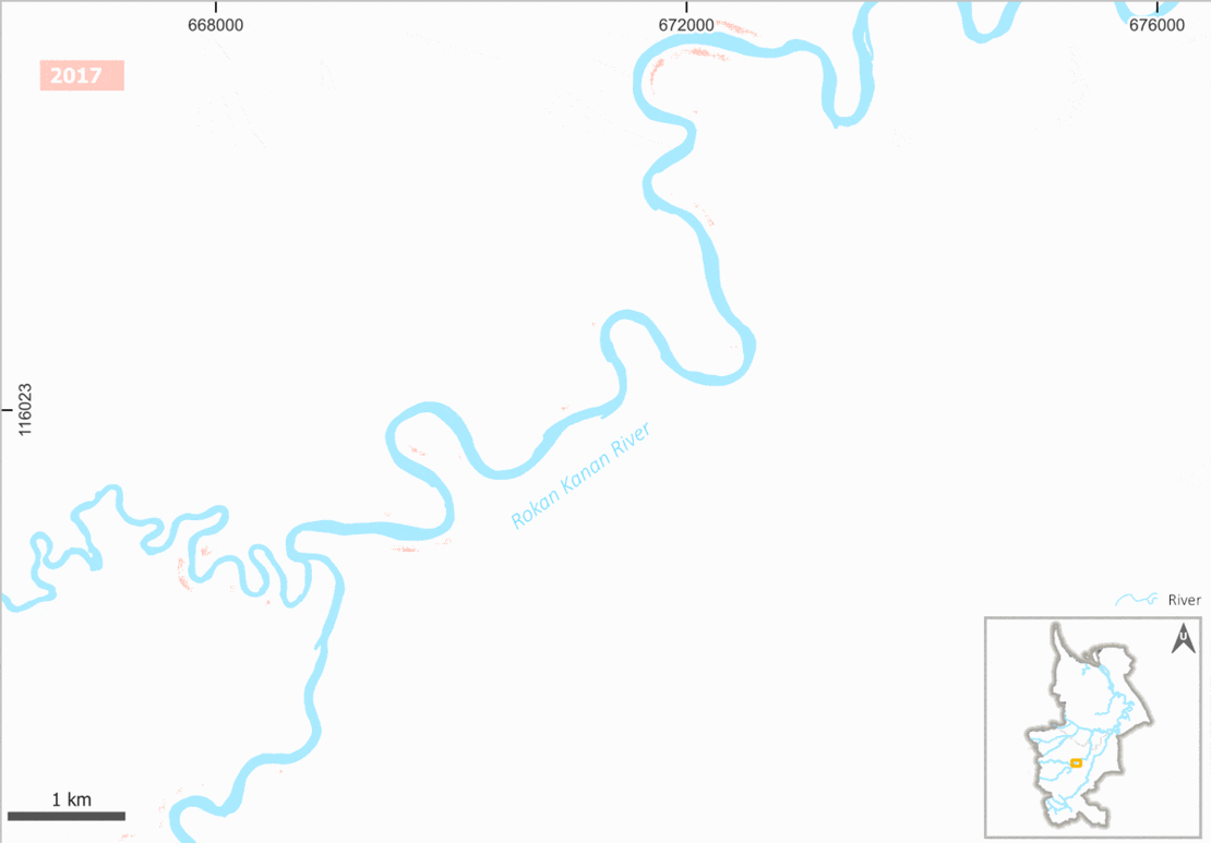
Figure 3. Detected expansion of oil palm along rivers over time
Training deep convolutional neural network models demands substantial computational resources, including extensive datasets, large memory capacity, and GPU processing power, which often exceed the capabilities of personal computing systems. Fortunately, the Geospatial Computing Platform provided by CRIB enabled an optimal computational environment for storing large-scale datasets, conducting experiments, and successfully training functional models. The platform's GUI applications, including QGIS and SNAP, facilitate efficient data exploration and preprocessing workflows. Additionally, CRIB features pre-installed deep learning packages and supports Jupyter Notebook environments, enabling users to execute their scripts seamlessly while eliminating the complexities of environment configuration and dependency management.
An interactive map of oil palm plantation on riparian zone overlaid with high resolution satellite image can be seen here. For further information on this research, check out thesis here.
For more information, please contact to Muhammad Afif Fauzan