Urban trees play a critical role in enhancing environmental quality, supporting biodiversity, and improving human well-being. Among them, oak trees (genus Quercus) are ecologically and culturally significant, often serving as keystone species in urban landscapes (Figure 1). However, effective management and conservation of urban oak populations require accurate, up-to-date, and spatially detailed information, which is often lacking in traditional tree inventories. Recent advancements in remote sensing technologies, particularly airborne LiDAR and high-resolution aerial imagery, offer new possibilities for large-scale urban tree mapping. When combined with deep learning, these data sources enable automated, species-specific detection and classification with high spatial fidelity.
Our research aims to develop and evaluate an integrated approach for mapping urban oak trees in the Netherlands by fusing airborne LiDAR and aerial photographs with deep learning methods. The objectives are to (1) design a data pipeline for detecting and classifying oak trees, (2) assess the accuracy and generalizability of the approach across diverse urban environments, and (3) explore the potential of this method for supporting urban forest monitoring and planning. By addressing current gaps in urban tree mapping, this study contributes to developing scalable tools for data-driven urban forestry.
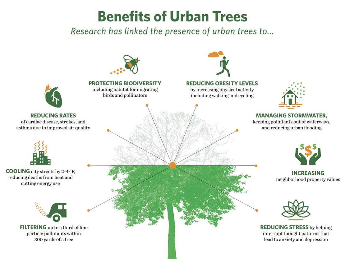
Figure 1. Benefits of trees in urban spaces
We employed a multi-source data fusion approach, combining airborne LiDAR point clouds and high-resolution aerial photographs to map urban oak trees in Dutch cities. A deep learning pipeline was developed using convolutional neural networks (CNNs) to detect tree crowns and classify oak species based on structural and spectral features. The methodology involved pre-processing LiDAR data to generate canopy height models, extracting candidate tree objects, and aligning these with spectral data from aerial imagery (Figure 2). Model training was conducted using manually annotated samples across diverse urban settings.
Preliminary results indicate high detection accuracy for individual tree crowns and promising species classification performance, particularly in areas with consistent canopy structure and minimal occlusion. Key challenges included data heterogeneity, occlusion in dense urban environments, and computational demands for processing large spatial datasets.
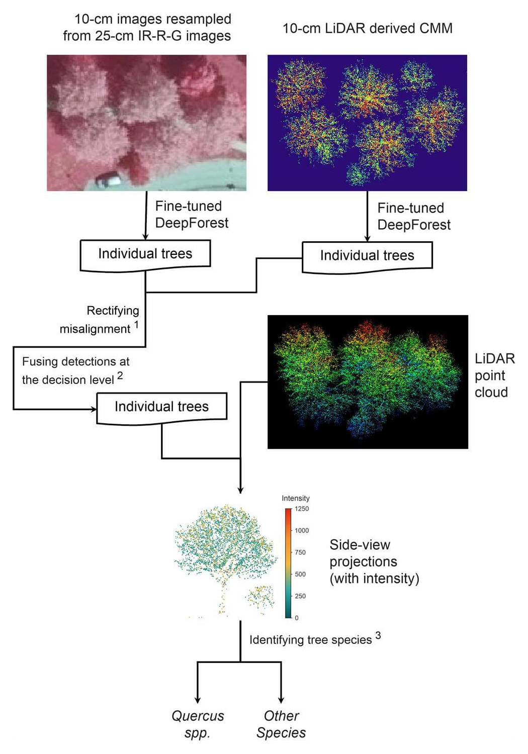
Figure 2. The workflow created canopy models from LiDAR, extracted tree objects, and combined them with aerial spectral data.
The Geospatial Computing Platform provided scalable storage, efficient data access, and high-performance computing resources that were essential for handling large-volume LiDAR data and training deep learning models. Its integrated tools facilitated spatial analysis and model iteration, significantly accelerating development and enabling experimentation across multiple urban areas. This computational support was critical in overcoming data-related and algorithmic constraints inherent in urban-scale tree mapping, enabling national-scale mapping of spatial distribution and density of oak trees in the Netherlands (Figure 3).
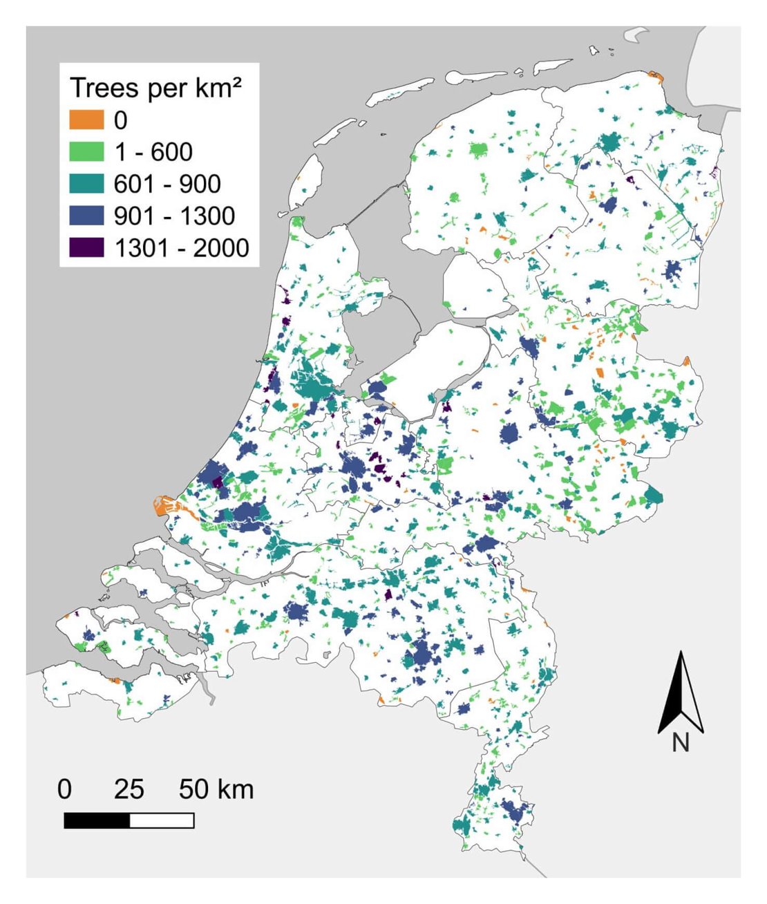
Figure 3. Spatial distribution and density of oak trees in the Netherlands
Using the Geospatial Computing Platform has been a transformative aspect of this research. Its seamless integration of large-scale spatial data processing, cloud-based storage, and machine learning tools enabled efficient analysis that would have been impractical on standard computing infrastructure. The platform's flexibility allowed for rapid model testing, streamlined data management, and collaborative development across locations. This experience not only enhanced the technical depth of the research but also broadened my perspective on scalable geospatial analysis. The platform proved invaluable in bridging the gap between complex urban datasets and actionable insights for ecological and urban planning applications.
For more information, please contact to Yi Xu.