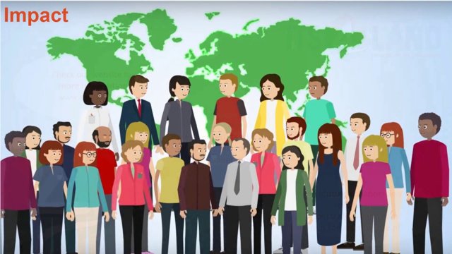
Using drones: From 3D mapping to disaster management
At the ITC Faculty at the University of Twente, we use our expertise on drones and unmanned aerial vehicles for multiple practical projects. For instance, ITC is an expert when it comes to 3D mapping and modelling. We can advise you also on the use of drones and photogrammetry in the area of disaster management. Drones and Unmanned Aerial Systems (UAS) are helpful tools when it comes to biodiversity mapping, land administration and water management. Have a look below and be inspired by what we at ITC can do for you when it comes to unmanned aerial vehicles, drones and photogrammetry.
- Classification and object detection
Images captured by UAVs allow the extraction of rich semantic information from objects that are otherwise either unrecognizable from low-resolution images provided by satellite platforms or too expensive to be mapped by typical high altitude airborne platforms. A variety of applications ranging from mapping of individual trees, plant species, weeds present in rice fields, vehicle detection, animal detection, building damage detection, and delineation of agricultural and cadastral boundaries can greatly benefit from this semantic information. UAVs also have lower costs for small project areas, shorter response time, and easier operation compared to their airborne platform counterparts—making UAVs more suitable for equivalent monitoring applications of the above-mentioned mapping use cases. The development of deep learning algorithms has increased the accuracy of automated processing, making these solutions a valid alternative in many applications. The inherent 3D information derived from UAV data also boosts image classification and object detection methods to extract desired information from our objects of interest. These promising characteristics of easily accessible and spatially rich semantic information provided by UAV data, combined with computationally efficient and effective algorithms, and other emerging technologies such as edge computing and IoT (Internet of Things) are paving the way for the development of real-time solutions for other novel and exciting applications.
The ITC centre is at the forefront of the development and deployment of these solutions specifically tailored for UAV images, as confirmed by the wide development of tailored solutions in past research projects and consultancies.
As a practical example, read this research to learn more about MultEYE on the website of MDPI Open Access Journals. MultEYE is a traffic monitoring system that can detect, track, and estimate the velocity of vehicles in a sequence of aerial images. This solution has been optimized to execute these tasks in real-time on an embedded computer installed on an Unmanned Aerial Vehicle (UAV).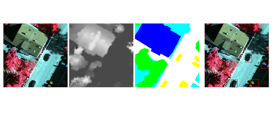
- Disaster management and hazards monitoring
The domain of disaster risk management is extensive, ranging from hazard assessment and monitoring, to early warning, event monitoring and response, up to post-event recovery.
Each of these phases is strongly reliant on spatial data, and UAV fill an important spatial scale gap that bridges synoptic, usually satellite-based assessment with field-based information. Given the diversity of environmental hazards, and elements at risk that range from the discrete (e.g., buildings) to the more abstract (e.g., economic systems, biodiversity), ITC’s research in this field is extremely variable and overlaps with other domains described on this page.
To date the main research focus has been on disaster response and (structural) damage mapping, taking advantage of UAV’s ability to provide detailed imagery from multiple perspectives that allow a detailed assessment of damages in particular in built-up environments, where appropriate by acquiring additional data types, such as thermal. Advanced machine learning and semantic scene understanding allow us to go beyond the identification of rubble piles or cracks in a building, supporting holistic per-building damage scores.
UAV are also increasingly able to enter structures, and research is ongoing on automated mapping of complex indoor spaces, as well as object identification, such as disaster victims. The chief ability of UAV to provide detailed imagery is further extended by its temporal flexibility: the frequency of observation can be adapted to match the dynamic of a phenomenon or process. For example, assessing landcover changes that impact flood or wildfire hazard may require only occasional images. On the other hand, monitoring ongoing hazard events or subsequent disaster response and clean-up require a far higher updating frequency, and UAV can provide both.
- Land administration
Contemporary land administration incorporates the concept of cadastre and land registration, often focusing on the security of land rights. It concerns the people-to-land relationship considering both formal and informal rights of the use and ownership of land. Despite its fundamental role for social and economic development, it is estimated that only 30% of the world’s population has documented land rights and has access to a formal cadastral system.
In response to this, fit-for-purpose (FFP) solutions have been developed to extract “general” boundaries with visual interpretation based on remotely sensed images rather than using “fixed” boundaries demarcated in the field and measured by a high precision Global Navigation Satellite System (GNSS) technology.
ITC’s recent research proved that UAVs are able to bridge the gap between field surveys and space/airborne surveys and promise flexible, cheap, real-time and fast data acquisition. Characteristics that are considered key for addressing current land administration challenges. The developed solutions offer high versatility and efficiency, allowing local stakeholders to acquire mapping data and empowering citizens to play the role in participatory mapping.