COVID-19 clusters
Spatial clustering methods are exploratory tools that are useful for making sense of complex geographic patterns. Knowing where clusters are located in space and time can be useful for formulating policies effective decision making. Early detection of high-risk hotspots can be crucial for targeting critical areas and prioritizing public health responses to these areas.
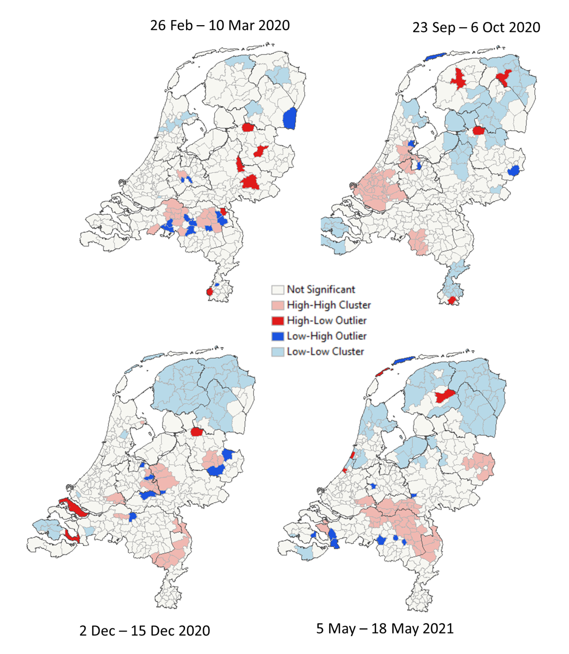
Project: The purpose of this project is to improve the utility of spatio-temporal clustering methods for enhancing rapid risk assessment and targeting response planning.