The course focuses on up-to-date knowledge and technology in the field of photogrammetry, Remote Sensing (RS) and digital image processing for geo-information extraction and production.
In this course, you will learn the theoretical concepts and practical skills to extract geoinformation in established upcoming techniques and innovative approaches. Besides, you will understand the connection of the acquisition and processing procedures, with the accuracy of the results and its relevancy for various applications.
Managing land use and the Earth’s resources and facing global challenges is becoming increasingly important due to the rising world population, economic growth, environmental degradation, and climate change, among others.
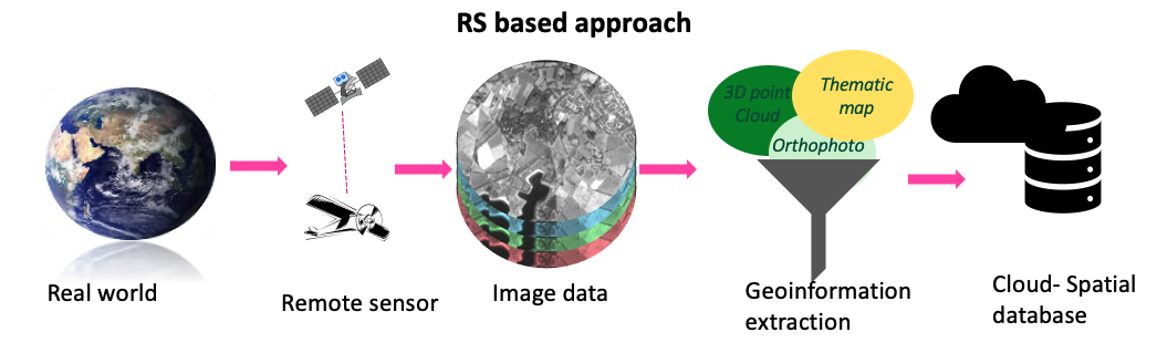
The use of available, up-to-date, accurate and well-structured geoinformation is essential for applying various applications and utilizing the data to face global challenges and reach optimal solutions. Thus, planners, resources managers and application scientists now make considerable use of frequently acquired high and medium resolutions of multispectral images and other data structures such as 3D point clouds. Multispectral images are captured from various spaceborne and airborne sensors, as well as innovative platforms such as drones, and 3D point clouds can be acquired with modern techniques such as laser scanners.
Thus, it is essential to train the staff to extract both thematic and 3D geoinformation from different sensors or scanners in automated and semi-automated processing environments which are continuously under development.
For whom is the course relevant?
- Staff from government agencies and private companies with practical professional experience in remote sensing and/or photogrammetry and who wish to become familiar with state-of-the-art knowledge and technology.
- GIS specialists who regularly use digitally acquired spatial reference data are interested in the source and accuracy of these data.
- Staff and researchers from non-geo disciplines who want to employ geoinformation in their research or work would also significantly benefit from this course.
What is the course content?
The course is structured in 4 sequential modules of 3 weeks each. The first two modules are concentrated on Remote sensing topics and the last two on photogrammetric topics. Learning outcomes are defined per module and evaluated progressively at the end of each one.
What will be achieved?
Upon completion of the RS modules, you will be able to:
- Select appropriate sensors and image data for geospatial problem solving
- Apply relevant contrast enhancement for visual and digital image analysis
- Apply spatial and temporal filters to improve image data for visual and digital image analysis
- Calculate indices and ratios for digital image analysis
- Apply different strategies for generating training and validation samples for supervised machine learning classifiers
- Apply various feature selection methods for data dimensionality reduction purposes
- Summarize the main multi-temporal image analysis steps
- Apply Random Forest classifier to classify both single-date and multi-temporal images
- Critically interpret the classification results obtained by applying supervised machine learning classifiers
Upon completion of the photogrammetry modules, you will be able to:
- Describe the UAV properties and classifications and distinguish the two main mapping applications
- Describe the sensor system properties, output data quality and applications for EO sensors with a focus on laser scanner and mobile mapping systems
- Explain 3D point cloud properties and data quality generated by a laser scanner, and apply basic processing methods on the 3D point clouds dataset for mapping applications
- Differentiate the quality of the positional control and define appropriate required positional accuracies for various applications
- Design flight planning for a specific application
- Understand image orientation procedures (direct and indirect) with a focus on digital aerial images.
- Apply image orientation procedures, point cloud and orthophoto generation procedures, and feature extraction procedures on drone images using the designated software.
- Process aerial oblique images (image orientation, point cloud, orthophoto generation) using the designated software
- Process the multispectral drone images using the designated software.
- Assess the quality of all the procedures mentioned above and the produced data.
About your diploma
Upon successful completion of this course, you will receive a Certificate which will include the name of the course.
Along with your Certificate you will receive a Course Record providing the name, and if applicable, all the subjects studied as part of the course. It states: the course code, subject, exam date, location and the mark awarded.
Admission requirements
Academic level and background
Applicants for this certificate course should have completed their secondary education in a discipline related to the course specialisation and have at least three years of relevant practical experience.
Documentation
The faculty accepts transcripts, degrees and diplomas in the following languages: Dutch, English, German, French and Spanish. It is at the discretion of the faculty to require additional English translations of all documents in other languages as well.
English language
As all courses are given in English, proficiency in the English language is a prerequisite.
If you are a national of one of the countries in this list (PDF), you are exempted from an English language test.
Please note: the requirements when applying for fellowships may vary according to the regulations of the fellowship provider.
English language tests: minimum requirements
Only internationally recognized test results are accepted.
TOEFL Paper-based Test (PBT) | 500 |
TOEFL Internet-based Test | 61 |
British Council / IELTS | 5.5 |
Cambridge | C2 Proficiency / C1 Advanced |
Computer skills
If you lack computer experience we strongly advise you to follow basic courses in your home country.
Academic level and background
Applicants for the Certificate programme should have a bachelor's degree or equivalent from a recognised university in a discipline related to the course, preferably combined with working experience in a relevant field.
Some courses in the Certificate programme or separate modules require knowledge of, and skills in, working with GIS and/or digital image processing of remotely sensed data.
Skills in taught or related subjects are a prerequisite for some courses in the Certificate programme or separate modules. Even if the applicant satisfies the overall admission requirements, acceptance is not automatic.
Documentation
The faculty accepts transcripts, degrees and diplomas in the languages: Dutch, English, German, French and Spanish. It is at the discretion of the faculty to require additional English translations of all documents in other languages as well.
Language skills
Success in your studies requires a high level of English proficiency. Therefore, prospective students with an international (other than Dutch) degree must meet the English language requirement. As proof that you meet this requirement, you will be asked in the application procedure to upload one of the requested language certificates:
- IELTS (academic) with an overall band score of at least 6.0 (with a minimum sub-score of 6.0 for speaking and writing) and certificates not older than two years.
- TOEFL iBT (internet-based) with an overall score of 80 (with a minimum sub-score of 20 for speaking) and certificates not older than two years. Please note that the University of Twente does not accept the MyBest scores of the TOEFL test.
- Cambridge C1 Advanced Formerly known as; Cambridge English Advanced (CAE), obtained with an A, B or C grade.
- Cambridge C2 Proficiency Formerly known as; Cambridge English Proficiency (CPE) obtained with an A, B or C grade.
Only these internationally recognised test results are accepted. Without a valid certificate, we cannot process your application.
Other requirements
- Ensure you have obtained a valid English test result before the application deadline. If your application is accompanied by a language test score report with a test date after our application deadline, we will not process it. Therefore, make sure to do the test in advance, as it will take time for you to get the official certificate.
- When applying for a scholarship, the language requirements may be different because scholarship providers may have different requirements.
Exemptions
You are exempted from the English language requirement if you hold:
- a relevant bachelor's degree from an accredited academic institution in the Netherlands
- if you are a national of one of the countries in this list (PDF)
- a three-year bachelor's degree in Australia, Canada (English-speaking part), Ireland, New Zealand, UK or USA. When your awarding institution is in one of these countries, but your teaching institution was not, you are not exempted. The same rule applies to distance (online) education.
Computer skills
If you lack computer experience, we strongly advise you to follow basic courses in your home country.
Notebook requirements
When you study in an ITC programme, you should have a notebook computer that meets ITC's technical notebook requirements.