The Agriculture Stress Index System (ASIS) project has been awarded the Geospatial World Excellence Award 2016. The project was initiated by FAO, the Food and Agriculture Organization of the United Nations, in collaboration the Joint Research Centre of the European Commission (JRC), the Flemish Institute for Technological Research (VITO), and ITC. The prize was awarded at the Geospatial World Forum in Rotterdam on the 25th of May.
In order to recognize and encourage innovations and excellence in the geospatial industry, Geospatial World has been conferring awards and recognitions for exemplary innovations and practices. This year, the Agriculture Stress Index System (ASIS) for Global Agriculture Drought Monitoring has been distinguished.
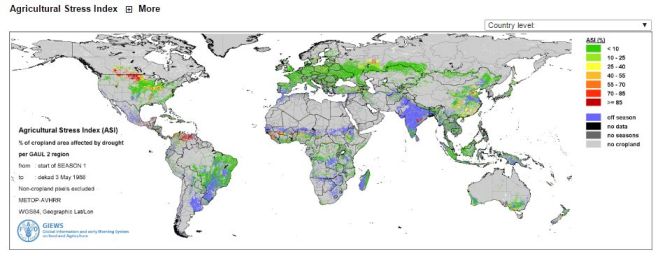
FAO has developed ASIS to support its global food security monitoring work by detecting agricultural areas with a high likelihood of water stress (dry-spells and drought), as part of their Global Information and Early Warning System on Food and Agriculture (GIEWS). The Agriculture Stress Index is based on Earth Observation data on vegetation and land surface temperature combined with information on agricultural cropping cycles and a global crop mask. The resulting index maps highlight areas of anomalous vegetation growth and potential drought in crop zones during the growing season.
For ITC, dr. Anton Vrieling, who is an assistant professor at the Department of Natural Resources, is part of the ASIS steering committee. He was the second author on a paper published in 2011 in Remote Sensing of Environment that led to the development of ASIS, which was officially launched in April 2015.