Purpose of Observation:
Main purpose of the Sardon site is the long-term monitoring of groundwater resources. The site, operational since 1994 (making it the longest, continuous groundwater record in the Iberian Peninsula), is considered a perfect site to train ITC students, test methods/ideas and to develop research interacting with education (typically PhD students have been working with Msc students) because, with respect to Water Resources, it is representative for a large part of developing countries where groundwater resources are in fractured rocks and it has a Mediterranean climate, typical for water limited environments which occur frequently in developing countries.
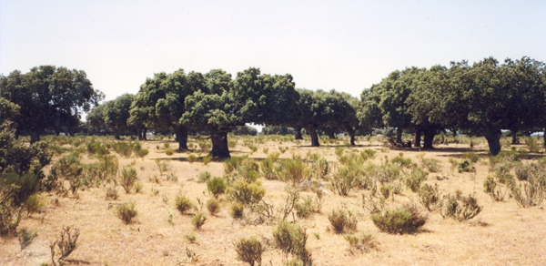
It is characterized by a relatively uniform geology with weathered and fractured granites and geologically-distinct catchment boundaries (~80 km2) covered by a savanna type of vegetation with two different, sparsely distributed phreatophytic oak tree species (deciduous Quercus pyrenaica, evergreen Quercus ilex) and shrubs (Citisius scoparius), i.e. vegetation typical for semiarid and/or arid conditions.
The area has a shallow water table, so with hand operated equipment and students’ work, it was possible to install automated, groundwater monitoring equipment. The area is very scarcely populated area, therefore very little human impact, making it perfect for studies of impact of climate change on groundwater resources. Furthermore the area is logistically very convenient: i) EU country, so no visa required for students; ii) it is safe – since the installation of the equipment, nothing was stolen or damaged; iii) friendly people and no dangerous animals; iv) proximity of the academic towns of Salamanca and La Coruna, providing opportunity for scientific collaborations; v) cheap flights through Madrid; v) convenient opportunity to store our equipment within the study area - storage house.
The monitoring network currently consists of 12 (5 piezometers, 5 deep boreholes and 2 explosive unused wells) groundwater logging recorders and two automated microclimatic stations, one in the upper-southern and the other in the lower-northern part of the catchment. At research peak time there were 16 (8 piezometers, 5 deep boreholes and 3 explosive unused wells) groundwater logging recorders, 2 microclimatic stations, one eddy covariance tower (in the northern part), and an automated river-discharge monitoring section at the large flume installed at the river outlet of the Sardon Catchment.
Participation in (Inter)National Programme/Campaigns:
- None
Collaboration:
- University of Salamanca, Salamanca, Spain
- University of La Coruña, La Coruña, Spain
- Wageningen University and Research, Wageningen, The Netherlands
- University of Grenoble, France
Externally Funded Projects:
- “Groundwater in hard rocks”, FCT, Portugal (budget 122 k€)
- “Magnetic resonance sounding (MRS) validation”, NWO, The Netherlands (budget 14 k€)
Major Scientific Achievements:
- The major achievements reached by using data collected at the Sardon Earth Observation site are provided in the publication of PhD dissertations, MSc theses, and several peer reviewed articles which are detailed below.
PhD Dissertations:
- L. Reyes Acosta (2015). Tree-water interactions at varying spatiotemporal scales in water limited environments. PhD dissertation, Enschede: University of Twente, Faculty of Geo-Information Science and Earth Observation (ITC).
- A.P. Frances (2015). Integration of hydrogeophysics and remote sensing with coupled hydrological models. PhD dissertation, Enschede: University of Twente, Faculty of Geo-Information Science and Earth Observation (ITC).
Ongoing:
- Tanvir Hassan. Impact of climate change on groundwater resources in water-limited, hardrock environments.
- Enrico Balugani. Partitioning of subsurface bare soil evaporation into unsaturated and saturated zone components. Collaboration with Wageningen University.
MSc Theses:
- Watat S. (1994). Groundwater recharge assessment and flow analysis of the lowest part of the lower Rio Tormes Basin; Province Salamanca, Spain.
- Wankweng B.C. (1996). Groundwater recharge assessment in a hardrock environment by well hydrograph analysis and groundwater chemistry: Rio Tormes basin, Salamanca province, Spain.
- Rwarinda E. (1996). Hydrogeological investigation in the Sardon Catchment, a part of the lower Rio Tormes Basin, Salamanca province, Spain.
- Kagaba S. (1997). Evaluation of groundwater resources in hard rocks by numerical flow modelling combined with GIS: Lower Rio Tormes basin, Salamanca province, Spain.
- Theodros G.E. (1997). GIS based groundwater vulnerability assessment : a case study in the lower Rio Tormes basin, Salamanca, Spain.
- Duah A.A. (1999). Groundwater recharge modeling in hard rocks using remote sensing and GIS applications: a case study in the Rio Tormes basin, Salamanca province, Spain.
- Worku M.S. (2000). Evaluating the applicability of NOAA AVHHR imagery for evapotranspiration studies in relation to LANDSAT TM and ground data : a case study in the lower Rio Tormes catchment, Spain.
- Mogesie A.W. (2000). Evaluation and assessment of temporal and spatial variability of actual evapotranspiration using remote sensing and GIS integrated techniques: a case study of the Sardon Sub-catchment, Spain.
- Uria-Cornejo S.P. (2000). Groundwater recharge modelling in hard rocks area: Sardon case study, Spain.
- Shakya D.R. (2001). Spatial and temporal groundwater modeling integrated with remote sensing and GIS : hard rock experimental catchment, Sardon, Spain.
- Fresilassie H.D. (2002). Groundwater modeling and evapotranspiration in a stressed river aquifer system.
- Frances A.P. (2008). Spatio-temporal groundwater recharge assessment: a data integration and modelling approach.
- Salinas A.I.R. (2008). A study case on the upscaling of tree transpiration in Water Limited Environments.
- Ruwan-Rajapakse, R.R.G. (2009). Numerical groundwater flow and solute transport modelling: a case study of Sardon catchment in Spain
- Ontiveros E.R. (2009). Tree transportation: a spatio - temporal approach in water limited environments, Sardon study case.
- Agbakpe, B.A. (2010). Estimating tree groundwater transpiration in La Mata catchment, Spain.
- Rwasoka, D.T. (2010). Evapotranspiration in water limited environments : up - scaling from crown canopy to the eddy flux footprint.
- Abubeker, A.M. (2010). Hydro - geophysical assessment of sub surface to improve groundwater models: Sardon case study, Spain.
- Mutasa C. (2011). Impacts of climate change on groundwater resources : a case study of the Sardon catchment, Spain.
- Deme G. (2011). Partitioning subsurface water fluxes using coupled Hydrus-Modflow model: case study of La Mata catchment, Spain.
- Cisneros-Vaca, C.R. (2011) Simulation of groundwater recharge in the Sardon catchment, Spain
- Daba, E.R. (2012). Assessment of subsurface water fluxes in La Mata catchment, Spain.
- Effendi I. (2012). Evapotranspiration in dry climate area: comparing remote sensing techniques with unsaturated zone water flow simulation
- Ginting, Y. (2013). Net recharge dependency on land cover type
- Weldemichael, M.Y. (2016). Integrated numerical modeling applying stratiform hydrogeological conceptual model : Sardon catchment study case, Spain.
- Tekle, Y.W. (2017). Scaling up Sardon Catchment groundwater recharge into Dehesa (Montado) hard rocks of Iberian Peninsula.
Publications:
- Balugani, E., Lubczynski, M. W., van der Tol, C., & Metselaar, K. A. (2018). Testing three approaches to estimate soil evaporation through a dry soil layer in a semi-arid area. Journal of hydrology, 567, 405-419. https://doi.org/10.1016/j.jhydrol.2018.10.018
- Hassan, S. M. T., Ghimire, C. P., & Lubczynski, M. W. (2017). Remote sensing upscaling of interception loss from isolated oaks: Sardon catchment case study, Spain. Journal of hydrology, 555, 489-505. https://doi.org/10.1016/j.jhydrol.2017.08.016
- Balugani, E., Lubczynski, M.W., Reyes-Acosta, J.L., van der Tol, C., Francés, A.P. and Metselaar, K. (2017) Groundwater and unsaturated zone evaporation and transpiration in a semi-arid open woodland: open access. Journal of hydrology, 547 (2017) pp. 54-66.
- Balugani, E., Lubczynski, M.W. and Metselaar, K. (2014). A framework for sourcing of evaporation between saturated and unsaturated zone in bare soil condition. Hydrological sciences journal, 61(11) pp. 1981-1995.
- Tanvir Hassan, S.M., Lubczynski, M.W., Niswonger, R.G. and Su, Z. (2014). Surface - groundwater interactions in hard rocks in Sardon Catchment of western Spain : an integrated modeling approach. Journal of hydrology, 517, pp. 390-410.
- Francés, A.P., Lubczynski, M.W., Roy J., Santos F.A.M., and Mahmoudzadeh M.R. (2014). Hydrogeophysics and remote sensing for the design of hydrogeological conceptual models – Sardon Catchment, Spain. Journal of Applied Geophysics, 110, pp. 63-81.
- Reyes-Acosta, J.L. and Lubczynski, M.W. (2014). Optimization of dry season sap flow measurements in an oak semi - arid open woodland in Spain. Ecohydrology, 7(2) pp. 258-277.
- Reyes-Acosta, J.L. and Lubczynski, M.W. (2013). Mapping dry season tree transpiration of an oak woodland at the catchment scale, using object attributes derived from satellite imagery and sap flow measurements. Agricultural and forest meteorology, 174-175, pp. 184-201.
- Reyes-Acosta, J.L. and Lubczynski, M.W. (2013) Mapping dry - season tree transpiration of an oak woodland at the catchment scale, using object - attributes derived from satellite imagery and sap flow measurements. In: Agricultural and forest meteorology, 174-175 (2013) pp. 184-201.
- Lubczynski, M.W., Chavarro-Rincon, D.C. and Roy, J. (2012) Novel, cyclic heat dissipation method for the correction of natural temperature gradients in sap flow measurements. Part 1. Theory and application. Tree physiology, 32 (2012)7 pp. 894-912.
- Reyes-Acosta, J.L., Vandegehuchte, M.W., Steppe, K. and Lubczynski, M.W. (2012) Novel, cyclic heat dissipation method for the correction of natural temperature gradients in sap flow measurements. Part 2. Laboratory validation. Tree physiology, 32 (2012)7 pp. 913-929
- Mahmoudzadeh, M.R., Francés, A.P., Lubczynski, M.W. and Lambot, S. (2012) Using ground penetrating radar to investigate the water table depth in weathered granites: Sardon case study, Spain. Journal of applied geophysics, 79 (2012) pp. 17-26.
- Francés, A.P. and Lubczynski, M.W. (2011) Topsoil thickness prediction at the catchment scale by integration of invasive sampling, surface geophysics, remote sensing and statistical modeling. Journal of hydrology, 405 (2011)1-2 pp. 31-47.
- Lubczynski, M. (2009). The hydrogeological role of trees in water - limited environments. Hydrogeology Journal, 17(1), 247-259.
- Lubczynski, M., & Roy, J. (2007). Use of MRS for hydrogeological system parameterization and modelling. Boletin Geologico y Minero, 118(3), 509-530.
- Lubczynski, M.W. and Gurwin, J. (2005). Integration of various data sources for transient groundwater modeling with spatio - temporally variable fluxes : Sardon study case, Spain. Journal of hydrology, 306 (2005)1-4 pp. 71-96.
- Lubczynski, M.W. and Roy, J. (2005). MRS contribution to hydrogeological system parameterization. Near surface geophysics, 3(2005)3, pp. 131-139.